Buschhorn (Bergisch Gladbach)
|
Bush horn
City of Bergisch Gladbach
Coordinates: 51 ° 0 ′ 44 ″ N , 7 ° 5 ′ 54 ″ E
|
||
|---|---|---|
|
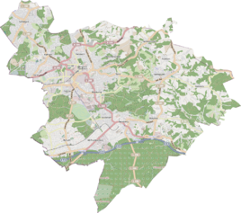
Location of Buschhorn in Bergisch Gladbach |
||
|
Half-timbered ensemble in Buschhorn
|
||
Buschhorn is a hamlet in the district Schildgen of Bergisch Gladbach .
history
The Buschhorn settlement emerged from an early medieval court establishment, which was mentioned in the 18th century as Boischorn in connection with a personal name. The original cadastre records the hamlet of Buschorn, which comprised nine farms in 1830, on Reutersweg (today's Voiswinkeler Straße) in the municipality of Unterodenthal. A larger number of Stone Age finds near Buschhorn suggest prehistoric and early historical settlement.
etymology

The basic word horn , as a description of the terrain, is derived from the Middle High German horn (= horn, protruding tip) and in Niederbergisch refers to a protruding forest tip or a pointed field.
Mining
The Eduard & Amalia mine was located in the vicinity of Buschhorn . There are only a few relics left. The sweeping heap of the machine shaft is located south of Buschhorn. In the adjoining valley is the so-called Green Pond . This is a ping from a former opencast mine that later ran full of water.
See also
Individual evidence
- ^ A b Andree Schulte, Bergisch Gladbach, city history in street names , published by the Bergisch Gladbach city archive, volume 3, and by the Bergisches Geschichtsverein department Rhein-Berg e. V., Volume 11, Bergisch Gladbach 1995, p. 52 f., ISBN 3-9804448-0-5
literature
- Anton Jux: The Bergisch Botenamt, the history of Bergisch Gladbach up to the Prussian era , published by the Culture Office of the City of Bergisch Gladbach, Bergisch Gladbach 1964

