Hydrographic Institute of Genoa
The Hydrographic Institute of the Navy , Italian Istituto Idrografico della Marina , in Genoa is the central Italian authority for maritime surveying and cartography . The institute is a military establishment of the Italian Navy and is also used for civil shipping .
tasks

- Surveying Italian waters and other relevant sea areas
- Publication of official nautical charts , nautical manuals and news for seafarers
- Oceanographic Research
- Testing and approval of navigation and radio equipment
- Development of special nautical instruments
- Support for other authorities and research institutions
- Training of domestic and foreign specialists as well as of students in cooperation with the University of Genoa
The institute represents Italy at the International Hydrographic Organization (IHO) and works primarily in the Mediterranean and Black Seas Hydrographic Commission (MBSHC). It currently has the high seas survey ship Magnaghi (A 5303) and the two modern catamarans Aretusa (A 5304) and Galatea (A 5308) . The annual circulation is around 120,000 nautical charts and 40,000 copies of other publications.
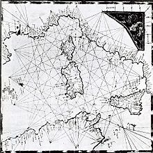
The library has a collection of antique nautical maps, including several portolan maps of the old Italian maritime republics .
history
The institute was founded on December 26, 1872 and housed in the Saint George fortress at the port of Genoa . The first head of the institute was the mathematician , hydrograph and then frigate captain Giovan Battista Magnaghi (1839-1902). Due to the very heterogeneous map material at the time, he was commissioned to determine the shape and depth of the sea areas surrounding Italy, the Mediterranean and some inland waters , and to document the results on uniform nautical charts.
After the First World War, surveying work in the Red Sea and the Indian Ocean was continued and marine and marine biological research was carried out there. After the Second World War, a new overall survey of the Italian waters was carried out with more modern means and methods. Over time, the institute expanded its work into various areas of oceanography. In cooperation with the Ministry of Cultural Property , the Hydrographic Institute locates and records archaeological monuments on the seabed ( Archeomar project ).
See also
- Oceanographic and Geophysical Institute of Trieste
- Federal Maritime and Hydrographic Agency of Germany
- NATO Undersea Research Center
- Italian Navy
- Italian coast guard
- Development history of the nautical chart
- Military Geography Institute of Florence
- Italian weather service

