Irkeshtam
|
Irkeschtam Иркештам |
||||
|
||||
| Basic data | ||||
|---|---|---|---|---|
| State : |
|
|||
| Territory : | Osh | |||
| Coordinates : | 39 ° 41 ′ N , 73 ° 54 ′ E | |||
| Height : | 2940 m | |||
| Residents : | 408 | |||
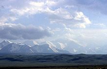
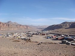
Irkeschtam ( Kyrgyz / Russian Иркештам ; according to other transcriptions Irkeshtam or Irkeštam ) is a place in the Kyrgyz region of Osh , located east of the Alai valley immediately before the Kyrgyz- Chinese border at an altitude of 2940 m . Irkeschtam has about 400 inhabitants.
Places in the immediate vicinity are Nura , 6 km southwest , which was destroyed by an earthquake on October 6, 2008, and Ikisjak , 13 km away.
Border crossing to China
After the Torugart Pass , 165 km northeast, the border crossing at Irkeschtam is the second most important road connection between Kyrgyzstan and China. The border town on the Chinese side is called Sumhana and is located in Ulugqat County in Kizilsu District in Xinjiang . After 55 km and after crossing the 2931 m high Karabel Pass you reach the city of Ulugqat.

Irkeschtam represents the eastern end of the European route 60 , which comes from Tajikistan through the Alai valley and Sarytasch , where the E 60 intersects the M 41 trunk road, the Osh in the Fergana valley over the Tschyiyrtschyk pass , the Taldyk pass and on the other connects via the Kyzyl-Art-Pass with Berg-Badachschan in Tajikistan. From Sarytasch to the east the 3723 m high Irkeschtam pass has to be crossed before the E 60 ends 78 km to Sarytasch at the Kyrgyz-Chinese border.
Due to the poor infrastructure, snow, border formalities and the partially closed border crossing (long lunch break), continuing to China can be difficult. Except for the east climb to the pass, where the road is under construction, the route from Sarytasch is newly developed and in very good condition. The Asian Development Bank provided US $ 32.8 million for the expansion of the 124 km long road between Irkeschtam and Osh. The project has been in progress since 2006. The road on the Chinese side to Kashgar is also in good condition, a Kashgar – Irkeschtam motorway is planned.
The pass was only reopened in 1998 after the Sino-Soviet rift in the early 1960s, but only for the movement of goods until 2002. Today, an average of one thousand vehicles cross the border at Irkeschtam every month; the border is open 24/7, but inspections are rare. Kyrgyz vehicles cannot enter China; they have to unload the loaded export goods , especially scrap , in front of the border, where they are picked up by Chinese drivers.
Individual evidence
- ↑ Data on Irkeshtam at Falling Rain Genomics (English)
- ↑ a b c Precursor Control on Central Asia's Borders with China (PDF; 638 kB) on unodc .org
- ↑ a b c Irkeshtam Pass, Kyrgyzstan on advantour.com
- ^ Richard WT Pomfret: The Central Asian Economies Since Independence . Princeton University Press, 2006. ISBN 978-0-691-12465-0


