Iron (river)
| Iron | ||
|
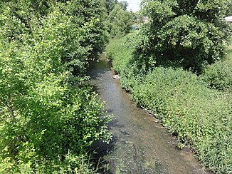
The river at the place of the same name Iron |
||
| Data | ||
| Water code | FR : H0061000 | |
| location | France , Hauts-de-France region | |
| River system | His | |
| Drain over | Noirrieu → Oise → Seine → English Channel | |
| source | on the municipal boundary of La Flamengrie and Le Nouvion-en-Thiérache 49 ° 59 ′ 12 ″ N , 3 ° 52 ′ 34 ″ E |
|
| Source height | approx. 219 m | |
| muzzle | on the municipal boundary of Hannapes and Vénérolles in the Noirrieu Coordinates: 49 ° 58 '20 " N , 3 ° 37' 43" E 49 ° 58 '20 " N , 3 ° 37' 43" E |
|
| Mouth height | approx. 108 m | |
| Height difference | approx. 111 m | |
| Bottom slope | approx. 4.4 ‰ | |
| length | approx. 25 km | |
The Iron is a river in France that runs in the Aisne department in the Hauts-de-France region . It rises on the municipal boundary of La Flamengrie and Le Nouvion-en-Thiérache , drains in an arc from southwest to northwest and, after around 25 kilometers, flows into the Noirrieu as a left tributary at the municipal boundary of Hannapes and Vénérolles , which is partly a canalized river serves for the canal Canal de la Sambre à l'Oise .
Places on the river
(Order in flow direction)
- Maubecque sharks , La Flamengrie municipality
- Buironfosse
- Leschelle
- Le Petit Dorengt , parish of Dorengt
- Lava cross
- Iron
- Jerusalem , Iron Community
Web links
Commons : Iron - collection of images, videos and audio files
