
Issoire (Vienne)
| Issoire | ||
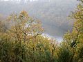
 The river at Brillac |
||
| Data | ||
| Water code | FR : L11-0300 | |
| location | France , Nouvelle-Aquitaine region | |
| River system | Loire | |
| Drain over | Vienne → Loire → Atlantic Ocean | |
| source | in the municipality of Blond 46 ° 1 ′ 46 ″ N , 1 ° 1 ′ 9 ″ E |
|
| Source height | approx. 373 m | |
| muzzle | at Saint-Germain-de-Confolens in the Vienne Coordinates: 46 ° 3 '22 " N , 0 ° 41' 0" E 46 ° 3 '22 " N , 0 ° 41' 0" E |
|
| Mouth height | approx. 125 m | |
| Height difference | approx. 248 m | |
| Bottom slope | approx. 5.4 ‰ | |
| length | 46 km | |
| Catchment area | 286 km² | |
| Left tributaries | Gaienne , Marchadaine , Courrière | |
| Reservoirs flowed through | Barrage de Saint-Germain-de-Confolens | |
The Issoire is a river in France that runs in the Nouvelle-Aquitaine region . It rises in the municipality of Blond , in the mountain range of the same name, Monts de Blond . The river initially drains north to northwest, then curves southwest to west and flows into the Vienne as a right tributary after a total of 46 kilometers in the municipality of Saint-Germain-de-Confolens . In its mouth section, the Issoire is dammed into a reservoir . On its way, the river crosses the Haute-Vienne and Charente departments .
The reservoir

dam


Places on the river
Web links
Commons : Issoire - collection of images, videos and audio files