
Köfels (municipality of Umhausen)
|
Köfels ( village ) locality |
|||
|---|---|---|---|
|
|||
| Basic data | |||
| Pole. District , state | Imst (IM), Tyrol | ||
| Pole. local community | Umhausen | ||
| Coordinates | 47 ° 7 '13 " N , 10 ° 55' 1" E | ||
| height | 1380 m above sea level A. | ||
| Residents of the village | 39 (January 1, 2020) | ||
| Post Code | 6441 | ||
| prefix | + 43/5255 | ||
| Statistical identification | |||
| Locality code | 16461 | ||
| Counting district / district | Tumpen-Niederthai (70223 001) | ||
 Town view of Köfels, seen from Niederthai |
|||
| Source: STAT : index of places ; BEV : GEONAM ; TIRIS | |||

Köfels is a village in the municipality of Umhausen in the Imst district in Tyrol with 39 inhabitants (as of January 1, 2020).
Köfels is located at around 1380 m above sea level. A. on a high plateau in the Ötztal Alps , which was formed during the Köfels landslide around 9,000 years ago. Köfels also owes the naming of Köfelsit after the town to this event .
In 1774 the branch church Köfels was built and restored in 1911. From the issue of the water usage rights in 1908 until the Second World War , a mill and later a sawmill was operated with water power in Köfels. Today only the restored and listed water wheel is evidence of the building.
Views

Expositurkirche Köfels

Köfels water wheel
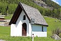
Corridor chapel Köfels


Web links
Commons : Köfels (Umhausen) - Collection of images, videos and audio files
Individual evidence
- ↑ Statistics Austria: Population on January 1st, 2020 by locality (area status on January 1st, 2020) , ( CSV )
- ^ Wasserrad Köfels , website of the municipality of Umhausen, viewed on June 19, 2016