Koeschinger Bach
| Koeschinger Bach | ||
|
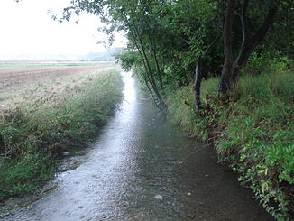
The Köschinger Bach shortly after its origin near Kösching |
||
| Data | ||
| Water code | DE : 13384 | |
| location | Bavaria (Germany) | |
| River system | Danube | |
| Drain over | Mailinger Bach → Danube → Black Sea | |
| source | in the Brunnhauptner Weiher near Kösching 48 ° 49 ′ 2 ″ N , 11 ° 29 ′ 10 ″ E |
|
| Source height | 385 m above sea level NN | |
| Spring discharge |
MQ |
140 l / s |
| muzzle | in Großmehring in the Mailinger Bach Coordinates: 48 ° 45 ′ 38 ″ N , 11 ° 31 ′ 19 ″ E 48 ° 45 ′ 38 ″ N , 11 ° 31 ′ 19 ″ E |
|
| Mouth height | 365 m above sea level NN | |
| Height difference | 20 m | |
| Bottom slope | 2 ‰ | |
| length | 10.2 km | |
The Köschinger Bach is a left tributary of the Mailinger Bach near Ingolstadt in Upper Bavaria .
course
The Köschinger Bach rises from the karst spring Brunnhauptner Weiher near Kösching . It flows first to the east into the core town and then bends in a southerly direction. Passing Desching , he reaches Großmehring . There it flows into the Mailinger Bach .
The knight's sword from Kösching was found in the bed of the Kösching brook in February 1997 .
Tributaries
- Klingenbach (left)
- Lentinger Bach (right)
- Dettelbach (left)
Web links
Commons : Köschinger Bach - Collection of images, videos and audio files

