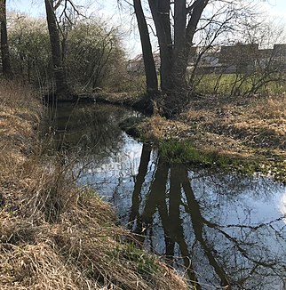
Mailinger Bach
|
Mailinger Bach left upper course: Retzgraben |
||
|
Mailinger Bach at Mailing |
||
| Data | ||
| Water code | EN : 1338 | |
| location | Bavaria (Germany) | |
| River system | Danube | |
| Drain over | Danube → Black Sea | |
| source | in Eitensheim 48 ° 49 ′ 8 ″ N , 11 ° 19 ′ 26 ″ E |
|
| Source height | 400 m above sea level NN | |
| muzzle | at the Vohburg barrage in the Danube Coordinates: 48 ° 46 ′ 29 ″ N , 11 ° 36 ′ 41 ″ E 48 ° 46 ′ 29 ″ N , 11 ° 36 ′ 41 ″ E |
|
| Mouth height | 360 m above sea level NN | |
| Height difference | 40 m | |
| Bottom slope | 1.5 ‰ | |
| length | 26.3 km with Retzgraben |
|
| Catchment area | 172.27 km² | |
| Runoff at the Unterhaunstadt gauge |
MNQ MQ MHQ HHQ (1993) |
40 l / s 140 l / s 1.78 m³ / s 3.51 m³ / s |
The Mailinger Bach is a left tributary of the Danube near Ingolstadt in Upper Bavaria .
course
The Mailinger Bach rises as the Retzgraben in Eitensheim, northwest of Ingolstadt. It crosses under the B 13 and flows strongly straightened towards the southeast to Gaimersheim . From there to Oberhaunstadt it is sometimes called the Haunstädter Bach . The Augraben coming from Buxheim flows into Unterhaunstadt . From here on it bears the name Mailinger Bach.
The Mailinger Bach then crosses under the A 9 , passes Mailing and joins the Köschinger Bach near Großmehring . There it flowed into the Danube in its natural state. After the construction of the Vohburg barrage , it had to be guided past it and now flows about three kilometers further, opposite the mouth of the Paar , into the Danube .
Tributaries
Hierarchical list, each from the source to the mouth. Selection.
- Retzgraben (left upper course)
- Güßgraben (left)
- Haunstädter Bach (right)
- Zellaugraben (left)
-
Excavation (right upper course)
- Breitwiesgraben (right upper course)
- Lohgraben (left upper course)
-
Köschinger Bach (left)
- Klingenbach (left)
- Lentinger Bach, with upper run name Manterinbach (right)
- Dettelbach (left)
Individual evidence
- ↑ a b Google Earth
- ↑ a b Directory of the brook and river areas in Bavaria - Lech to Naab river area, page 32 of the Bavarian State Office for the Environment, as of 2016 (PDF; 2.9 MB)
- ^ Bavarian flood news service
