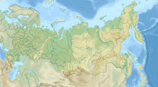
Kama Heights
| Kama Heights | ||
|---|---|---|
| Highest peak | Krasnoyar ( 337 m ) | |
| location | Kirov Oblast , Udmurt Republic , Perm Region (Russia) | |
| part of | High Savolschye | |
|
|
||
| Coordinates | 58 ° 30 ′ N , 54 ° 0 ′ E | |
| rock | Mudstone , marl , sandstone | |
The Upper Kama Upland ( Russian Верхнекамская возвышенность , Werchnekamskaja woswyschennost) are one to 337 m high ridge in the eastern part of Russia , upstream of the Kama .
The ridge is the origin of the Kama and many of its tributaries, including Tschepza (tributary of the Kaman tributary Vyatka ), Kossa and Inwa . The ridge is highly fragmented and averages between 240 and 280 m, the plateaus 300–335 m high.
The highest point of the Kama Heights is Krasnoyar Mountain in Afanassjewo Raion in Kirov Oblast. In the low mountain range covered with coniferous forests, deposits of crude oil are suspected.
literature
- A. Gorkin and others: Geografija Rossii: Enziklopeditscheski slowar . Bolschaja Rossijskaja enziklopedija, Moscow 1997, ISBN 5-85270-276-5 , p. 101. (Russian)
- W. Tuganajew and others: Udmurtskaja Respublika: enziklopedija . Udmurtija, Izhevsk 2000, ISBN 5-7659-0732-6 . P. 227. (Russian)
Web links
- Article Kama Heights in the Great Soviet Encyclopedia (BSE) , 3rd edition 1969–1978 (Russian)
