Kerezky
| Kerezky | ||
| Керецьки | ||

|
|
|
| Basic data | ||
|---|---|---|
| Oblast : | Zakarpattia Oblast | |
| Rajon : | Svalyava Raion | |
| Height : | 260 m | |
| Area : | 0.6 km² | |
| Residents : | 4,324 (2004) | |
| Population density : | 7,207 inhabitants per km² | |
| Postcodes : | 89334 | |
| Area code : | +380 3133 | |
| Geographic location : | 48 ° 29 ' N , 23 ° 13' E | |
| KOATUU : | 2124082901 | |
| Administrative structure : | 1 village | |
| Address: | вул. Головна 52 89334 с. Керецьки |
|
| Website : | City council website | |
| Statistical information | ||
|
|
||
Kerezky ( Ukrainian Керецьки ; Russian Керецки Kerezki , Slovak Kerecky , Hungarian Kerecke ) is a village in the Ukrainian Zakarpattia Oblast with about 4,300 inhabitants.
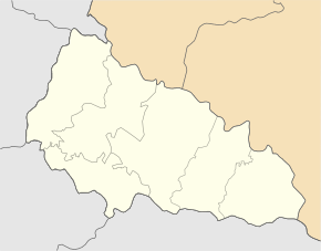
Kerezky is a village in the Forest Carpathians at 260 m altitude on the banks of the Borschawa and on the T-07-12 territorial road . It was in 1389 first mentioned and is the only resort of the same name 4,882 km² District Municipality in Svaliava Raion .
The Rajonzentrum Svalyava is 20 km and the Oblastzentrum Uzhhorod 88 km northwest of Kerezky.
Until 1919 the village belonged to the Hungarian half of the Austro-Hungarian Empire and subsequently to the Carpathian Ukraine within Czechoslovakia . With the annexation, the village came back to Hungary between 1939 and 1945. After the Second World War , Kerezky became part of the Ukrainian Soviet Socialist Republic within the Soviet Union in 1946 and, since 1991, of the independent Ukraine .
Individual evidence
- ↑ Kerezky on the official website of the Verkhovna Rada , accessed on August 27, 2017 (Ukrainian)
- ^ History of the towns and villages of the Ukrainian SSR - Kerezky ; accessed on August 29, 2017 (Ukrainian)
- ↑ Website of the municipal council , accessed on August 27, 2017 (Ukrainian)


