Kings Highway (Australia)
| Kings Highway | |||||||||||||||||||||||||||||||||||||||||||
|---|---|---|---|---|---|---|---|---|---|---|---|---|---|---|---|---|---|---|---|---|---|---|---|---|---|---|---|---|---|---|---|---|---|---|---|---|---|---|---|---|---|---|---|

|
|||||||||||||||||||||||||||||||||||||||||||
| map | |||||||||||||||||||||||||||||||||||||||||||
| Basic data | |||||||||||||||||||||||||||||||||||||||||||
| Operator: | Roads and Maritime Services | ||||||||||||||||||||||||||||||||||||||||||
| Start of the street: |
Capital Circle Capital Hill ( Canberra ) ( ACT ) ( 35 ° 19 ′ S , 149 ° 8 ′ E ) |
||||||||||||||||||||||||||||||||||||||||||
| End of street: |
Batemans Bay ( NSW ) ( 35 ° 42 ′ S , 150 ° 11 ′ E ) |
||||||||||||||||||||||||||||||||||||||||||
| Overall length: | 145 km | ||||||||||||||||||||||||||||||||||||||||||
|
States : |
|||||||||||||||||||||||||||||||||||||||||||
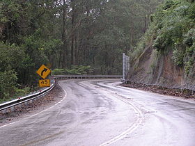
| Kings Highway on Clyde Mountain | |||||||||||||||||||||||||||||||||||||||||||
|
Course of the road
|
|||||||||||||||||||||||||||||||||||||||||||
The Kings Highway is a trunk road in the southeast of the Australian state of New South Wales and in the east of the Australian Capital Territory . It connects the Australian capital Canberra with the Princes Highway in Batemans Bay on the New South Wales coast.
course
The street begins as Canberra Avenue on Capital Hill in the center of the capital and heads southeast. Between the districts of Fyshwick and Symonston , it crosses the Monaro Highway (R23) and the border into New South Wales, after which it reaches the town of Queanbeyan .
There the Kings Highway turns east-northeast and passes through the settlements of Bungendore and Doughboy . At Doughboy, the road turns southeast and crosses the ridge of the Great Dividing Range . Via Braidwood it leads past Clyde Mountain and separates Budawang National Park in the north and Monga National Park and the Clyde River National Park in the south. It crosses the Clyde River at Nelligen and then falls to the coast at the seaside resort of Batemans Bay, where it meets and ends on the Princes Highway (R1).
Web links
source
Steve Parish: Australian Touring Atlas . Steve Parish Publishing. Archerfield QLD 2007. ISBN 978-1-74193-232-4 . Pp. 34, 35, 37, 38

