Budawang National Park
| Budawang National Park | ||
|---|---|---|
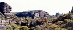
| Monolith Valley in the Budawang Range | ||
|
|
||
| Location: | New South Wales , Australia | |
| Specialty: | Sandstone cliffs, coastal mountain landscape | |
| Surface: | 237 km² | |
| Founding: | 23rd September 1977 | |
| Summit of Dithol or Pigeon House Mountain in the adjacent Morton National Park | ||
The Budawang National Park is a national park in the southeast of the Australian state of New South Wales , 200 km south of Sydney and 65 km east of Canberra . The Kings Highway is its southern limit. In the north, across the Yadboro River , a tributary of the Clyde River , the Budawang Wilderness Area joins, in the east the Bimberamala National Park . Both the national park and the Wilderness Area of the same name comprise part of the Budawang Range , a mountainous area in the coastal mountains of New South Wales.
The area was colonized from 1820. The remains of an old sawmill can still be found in the park. The adjoining coastal region was not settled until 1890 because of its poor accessibility.
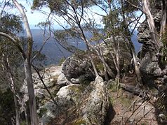
The highest point is Mount Budawang , which provides a good view of the entire mountain range, the river system of the Clyde River and the coastline in the distance.
The park can only be reached via unpaved roads, preferably from the west via the Braidwood - Mongarlowe - Nerriga - Nowra road . There are no tourist facilities in the park. In particular, make sure you bring enough drinking water and food with you when hiking.


