Nymboida National Park
| Nymboida National Park | ||
|---|---|---|
| Nymboida River | ||
|
|
||
| Location: | New South Wales , Australia | |
| Specialty: | untouched river valleys | |
| Next city: | Jackadgery, Cangai | |
| Surface: | 404.92 km² | |
| Founding: | September 19, 1980 | |
The Nymboida National Park is a national park in the northeast of the Australian state of New South Wales , 485 km north of Sydney , 50 km west of Grafton and 60 km east of Glen Innes .
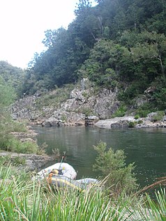
The park is south of the Gwydir Highway . The Gibraltar Range National Park connects to the north and the Barool National Park to the west . The Mann River and its tributary, the Nymboida River , flow through the park. The mouth of the Nymboida River lies in the eastern part of the national park.
The Nymboida National Park can only be reached on unpaved roads and has no tourist facilities. You can go whitewater trails on both rivers. Swimming is also very popular.
Web links
Individual evidence
- ^ Steve Parish: Australian Touring Atlas. Steve Parish Publishing Pty. Ltd. Archerfield QLD (2007). ISBN 978174193232-4 . P. 29
- ↑ a b Nymboida National Park . NSW Environment & Heritage Office

