Cottan Bimbang National Park
| Cottan Bimbang National Park | ||
|---|---|---|
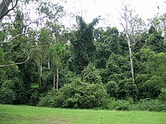
| Rainforest at the picnic area on Stockyard Creek | ||
|
|
||
| Location: | New South Wales , Australia | |
| Specialty: | Eucalyptus primary forest | |
| Next city: | Walcha | |
| Surface: | 269 km² | |
| Founding: | 1999 | |
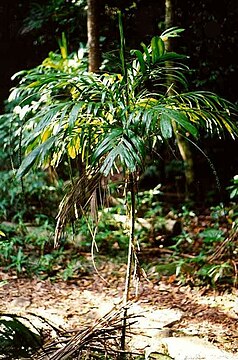
| Wandering stick palm ( Linospadix monostachya ) | ||
The cottan-bimbang national park is a national park in eastern Australian state of New South Wales .
location
The park is located in the eastern stepland, 443 kilometers north of Sydney and 65 kilometers south of Walcha . The Oxley Highway crosses the park south of Werrikimbe National Park. The Myrtle Scrub Road is a 15 kilometer long ring road in the western part of the park and connects it with the Oxley Highway.
Flora and fauna
The former state forest is home to primary forest with very tall eucalyptus trees , rainforest , endangered frog species , yellow-bellied glider ( Petaurus australis) and koalas . "Cottan-bimbang" is an Aboriginal term for walking stick palm (Linospadix monostachya) that grows in the temperate rainforest of the park.
Blackberries ( Rubus ) are an introduced species and therefore pose a serious weed problem.
Facilities
There is a barbecue and picnic area , as well as public restrooms, on Stockyard Creek on Oxley Highway and a cleared picnic area on the Cells River on Myrtle Scrub Road. At Maxwells Flat on Causeway Road is a campground with a dry toilet.


