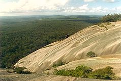
Bald Rock National Park
| Bald Rock National Park | ||
|---|---|---|
| View from the top of Bald Rock | ||
|
|
||
| Location: | New South Wales , Australia | |
| Specialty: | Granite mountain | |
| Next city: | Tenterfield | |
| Surface: | 75 km² | |
| Founding: | 1971 | |
The Bald Rock National Park is established on 12 November 1971 75 km² large national park in the north of the Australian state of New South Wales on the border with Queensland .
The park is named after the "Bald Rock", a granite elevation that towers over 200 m above the surrounding area , and is located in the granite belt , a region in southeast Queensland that is characterized by a high occurrence of this type of rock. About 200 million years ago, Stanthorpe Adamellite , a type of rock with granite-like properties, a tonalite , intruded into the existing sediments and metamorphic rocks . While these rocks eroded , the more resilient Stanthorpe Adamellite was preserved. The regolithic rock has created a landscape with many island mountains in the area of the park .
Web links
- Bald Rock National Park on environment.nsw.gov.au

