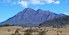
Gondwana rainforests of Australia
The Gondwana Rainforests (Engl. Gondwana Rainforests of Australia until 2007 Central Eastern Rainforest Reserves ) are on the borderline of the two ostaustralischen states New South Wales and Queensland . In 1986 the subtropical rainforest areas in northern New South Wales were added to the UNESCO World Heritage List and other rainforest national parks were also entered into the Australian National Heritage List . In 1994 the world heritage was extended to the northern parts of Queensland. They include several protected areas that contain shield volcanoes and a large number of rare and threatened species of the rainforest.
UNESCO world heritage
The name Gondwana rainforests is derived from the supercontinent Gondwana , as the current vegetation of the rainforests also includes species whose existence could already be proven at the time of Gondwana based on fossil plant finds. These include B. stone beeches , beeches and araucarias , which already grew in the time of the Jurassic and Chalk .
The following national parks are part of the UNESCO World Heritage:
- In New South Wales
- Barrington Tops National Park
- Border Ranges National Park
- Dorrigo National Park
- Gibraltar Range National Park
- Mebbin National Park
- Wollumbin National Park
- New England National Park
- Nightcap National Park
- Oxley Wild Rivers National Park
- Washpool National Park
- Werrikimbe National Park
- Willi-Willi National Park
- In Queensland
Australian National Heritage List
The Gondwana Rainforests of Australia are broken down into the protected areas listed on the Australian National Heritage List :
Main Range Group

The Main Range Group is located near Killarney
- Acacia Plateau Flora Reserve
- Main Range National Park
- Spicers Gap Conservation Park
- Goomburra State Forest (partially)
- Spicers Gap State Forest (partially)
- Gilbert State Forest (partially)
- Emu Vale State Forest (partially)
- Gambubal State Forest (partially)
- Teviot State Forest (partially)
Focal Peak Group
The Focal Peak Group lies on the border of New South Wales and Queensland
- Captains Creek Flora Reserve (partially)
- Mallanganee National Park
- Mount Clunie National Park (partially)
- Mount Nothofagus National Park (partially)
- Tooloom National Park (partially)
- Toonumbar National Park (partially)
- Burnett Creek State Forest (partially)
Shield Volcano Group
This group is close to the border with New South Wales and Queensland on the McPherson Range and Tweed Range
- Amaroo Flora Reserve
- Border Ranges National Park (partially)
- Lamington National Park
- Limpinwood Nature Reserve
- Mebbin National Park (partially)
- Mount Chinghee National Park
- Mount Warning National Park
- Nightcap National Park (partially)
- Numinbah Nature Reserve
- Springbrook National Park (partially)
- various Rabbit Board Reserves along the Rabbit-Proof Fence .
Iluka Nature Reserve
Iluka Nature Reserve is located on the coast of Iluka .
Washpool and Gibraltar Range
These parks are between Glenn Innes and Grafton in New South Wales
See also
Web links
Coordinates: 28 ° 15 ′ 0 ″ S , 150 ° 3 ′ 0 ″ E


