Bribie Island
| Bribie Island | ||
|---|---|---|
| Bridge to Bribie Island | ||
| Waters | Coral sea | |
| Geographical location | 27 ° 0 ′ S , 153 ° 7 ′ E | |
|
|
||
| length | 34 km | |
| width | 8 kilometers | |
| surface | 148 km² | |
| Residents | 16,209 (2006) 110 inhabitants / km² |
|
| main place | Bongaree | |
| Location of Bribie Island in Australia | ||
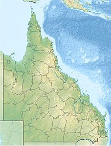
Bribie Island is a large sand island off the coast of Australia . It is located about 70 kilometers north of Queensland's capital Brisbane and forms the northern end of Moreton Bay . Bribie Island is 34 kilometers long and up to eight kilometers wide. Bribie Island is separated from the mainland by the Pumicestone Passage ("pumice stone passage").
history
18th and 19th centuries
The first European to see the island was James Cook in May 1770. On his first voyage of discovery in April 1770 , he discovered Botany Bay , now Sydney , and on his way north along the Australian coast passed Moreton Bay and Bribie Iceland. He also named the Pumicestone Passage after noticing smaller pieces of pumice stone in the water there. However, he passed the island itself without exploring or naming it.
In 1799 it was Matthew Flinders who was the first European explorer to set foot on and explore the island. He is said to have met very unfriendly Aborigines who lived on the island.
The island did not get its name until the middle of the 19th century from a prisoner of the Moreton Bay penal colony who was a talented shrimp catcher, for which he was finally rewarded with his freedom by the guards of the penal colony. Bribie married an Aboriginal woman and settled with her on the island that has been named after him ever since.
20th century
The further development and settlement of Bribie Island proceeded very slowly. A fish factory only existed for a few years, the first jetty was built in 1912 and the first car was transported to the island in 1919. The connection to the power grid was not made until 1953.
The island experienced a major development spurt from 1963 when the bridge over the Pumicestone Passage to the mainland was built. Bribie Island was the first island in Queensland to be connected to the mainland by a bridge.
present
Today about 16,000 people live on Bribie Island. The island is a popular destination for tourists.
The island can now be divided into two larger zones: On the one hand, the uninhabited and forested north, which is largely protected by the Bribie Island National Park, and on the other hand, the inhabited south of the island. Locals also differentiate between the quiet Passage Side along the Pumicestone Passage in the west of the island and the rather stormy Surf Side on the east coast of the island.
Inhabited areas
On Bribie Island there is no main town or city, but several districts that are administered by the Moreton Bay Regional Council . There are currently four inhabited districts. These are from north to south on the Passage Side Banksia Beach, Bellara and Bongaree and Woorim as the only district on the Surf Side . A fifth district, Welsby, is noted on some maps, but no construction or development work has yet taken place there.
Bribie Island has enjoyed increasing popularity in recent years as a retreat with Australians, as well as a holiday destination for tourists who are looking for some peace and seclusion from the major tourist strongholds.
The infrastructure on the island is now comparable with other small towns. There are several shopping centers in which all the major supermarket chains in the country are represented, several hotels of all classes, a cinema, two golf courses and a bus connection to Caboolture . In Caboolture there is a connection to the train connection to Brisbane.
Bribie Island National Park
The Bribie Island National Park , founded in 1994, has an area of 96.60 km². It starts north of Banksia Beach and extends as a ribbon along the west coast to The Spit on the northern tip of the island and further along the east coast south to Woorim. In the interior of the island there are pine forests and wetlands that are not part of the national park.
Kangaroos , wallabies , emus , dingoes and numerous reptiles and snakes live in the national park . About 200 different species of birds can be found on the island and dolphins live in the waters around the island.
The park is well developed for tourism. There are several picnic and camping sites that can be reached by four-wheel drive vehicles or by boat. There are several routes in the park that can only be used with four-wheel drive vehicles. In many places it is allowed to drive on the beach. In order to drive into the park, you need a permit, which can be obtained from the national park administration or the local authorities.
Web links
- Bribie Iceland National Park and Recreation Area (English)
- Walkabout Travel Guide (English) ( Memento from January 31, 2009 in the Internet Archive )
- Ourbrisbane.com
Individual evidence
- ↑ Australian Government - CAPAD 1997 ( MS Excel ; 93 kB), DSEWPaC , accessed on January 7, 2013 (English)
- ↑ Australian Government - CAPAD 2010 ( MS Excel ; 170 kB), DSEWPaC , accessed on January 7, 2013 (English)


