Monga National Park
| Monga National Park | ||
|---|---|---|
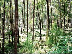
| Eucalyptus forest in Monga National Park | ||
|
|
||
| Location: | New South Wales , Australia | |
| Specialty: | Eucalyptus forest, cold temperate rainforest | |
| Surface: | 251.44 km² | |
| Founding: | January 1, 2001 | |
The Monga National Park is a national park in the southeast of the Australian state of New South Wales , 230 kilometers south of Sydney . It joins the Budawang National Park to the south , from which it is separated by the Kings Highway , and to the north to the Deua National Park , from which it is separated by the Deua River . The closest major towns are Braidwood to the west and Batemans Bay to the east.
The park offers beautiful eucalyptus high forest and cool, temperate rainforest .
photos
Pinkwood (Eucalyptus moorei) as a hemiphyte on a Soft Tree Fern (Dicksonia Antarctica) in Monga National Park
A group of eucalyptus trees (Eucalyptus fastigata) in Monga National Park
Web links
Commons : Monga National Park - Collection of pictures, videos and audio files


