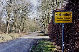
Klattenhof
|
Klattenhof
municipality Dötlingen
Coordinates: 52 ° 59 ′ 20 ″ N , 8 ° 27 ′ 36 ″ E
|
||
|---|---|---|
| Height : | 35 m above sea level NHN | |
| Residents : | 138 (Jun 30, 2012) | |
| Postal code : | 27801 | |
| Area code : | 04432 | |
|
Location of Klattenhof in Lower Saxony |
||
|
The old Bassumer Weg leads through the village.
|
||
Klattenhof is a district of the municipality of Dötlingen in the Lower Saxony district of Oldenburg in the Wildeshauser Geest Nature Park .
The on the northeastern outskirts of the village of Dötlingen and southwest of the state forest Stühe located peasantry has 138 inhabitants (as of 30 June 2012) and has several agricultural full-time farms on. In addition to the individual farmsteads Brandkuhle , Feldhake and Gut Welsburg, Klattenhof also includes the approximately 55 hectares of Welsburger Holz.
- Association: Klattenhof village community
Personalities
- Hasen-Ahlers (1831–1913) was the most famous poacher in the Oldenburg region
- Helga Schmidt (1937–2018), swimmer, participant in three Olympic Games in 1956 , 1960 and 1964, lived in Klattenhof


