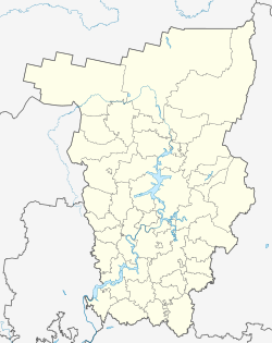
Kondratowo (Perm)
| Village
Kondratowo
Кондратово
|
||||||||||||||||||||||||||||||||||
|
||||||||||||||||||||||||||||||||||
|
||||||||||||||||||||||||||||||||||
| List of large settlements in Russia | ||||||||||||||||||||||||||||||||||
Kondratowo ( Russian Кондра́тово ) is a village (derevnja) in the Perm region in Russia with 10,023 inhabitants (as of October 14, 2010).
geography
The place is about 10 km as the crow flies southwest of the center of the regional capital Perm on the left bank of the Muljanka , a left tributary of the Kama , about 4 km above the mouth. The Muljanka marks the city limits of Perm there.
Kondratowo belongs to the Permsky Rajon , whose administrative seat is also Perm. The village is the seat of the rural community Kondratovskoye selskoje posselenije, which also includes the villages of Bereg Kamy (5 km northwest, on the bank of the Kama, which the place name also means) and Saossinowo (7 km west-northwest). Kondratowo was in the census of 2010, the fourth largest town in Russia with the usual mostly for smaller villages Status Derevnya after Watutinki in the Moscow Oblast , the but with the incorporation to Moscow as part of the community in 2012 (posselenije) Dessjonowskoje lost its independence, Novoye Dewjatkino in Leningrad Oblast and Davydovo in Moscow Oblast.
history
The place was first mentioned in 1647 under the name Artemjewa in a listing of the estates of the Stroganov , after the founder Artemi (Artemeika) Verkholanzew. In 1782 the Kondratowa form was first guaranteed, after a Kondrat Baklanov who lived there, but the original form was still used until the 19th century. In 1869 the name Kondratowa was established, later changed to the current form.
Until the 1980s Kondratowo remained an insignificant village with only a few hundred inhabitants. In the meantime, the megacity of Perm had expanded almost to the south-west, and the first prefabricated buildings were being built in the suburb . The housing development initially was called Pervomaisky, but belonged administratively to the village always Kondratowo. Construction activity continued in the 1990s to 2000s, including more and more homes. Despite the urban character, especially the central part of the place, it has so far retained the status of a village.
Population development
| year | Residents |
|---|---|
| 2002 | 5,736 |
| 2010 | 10,023 |
Note: census data
traffic
To the west of Kondratowo, the Perm bypass runs along the branch of the M7 Volga federal trunk road leading to Perm . South of the village this is crossed by the arterial road from Perm in the direction of Bolshoye Savino Airport and further as regional road 57K-0014 to Ust-Katschka (formerly R345). There, near the Perm district of Verkhniye Mully, the road that leads directly through Kondratowo joins, which continues in a north-westerly direction to the M7 and its western approach to Perm near Bereg Kamy, not far from the third Perm Kama road crossing opened in 2005/2008 , 7 km long Krassawinski Bridge along the M7.
There is city bus service to Perm, in the western part of which there is also the closest train station Perm II on the Trans-Siberian Railway .
Web links
- Official website of the local government (Russian)
Individual evidence
- ↑ a b Itogi Vserossijskoj perepisi naselenija 2010 goda. Tom 1. Čislennostʹ i razmeščenie naselenija (Results of the All-Russian Census 2010. Volume 1. Number and distribution of the population). Tables 5 , pp. 12-209; 11 , pp. 312–979 (download from the website of the Federal Service for State Statistics of the Russian Federation)

