Koskullskulle
| Koskullskulle | ||||
|
||||
| State : | Sweden | |||
| Province (län): | Norrbotten County | |||
| Historical Province (landskap): | Lapland | |||
| Municipality : | Gällivare | |||
| Coordinates : | 67 ° 11 ′ N , 20 ° 44 ′ E | |||
| SCB code : | 8694 | |||
| Status: | Crime scene | |||
| Residents : | 818 (December 31, 2015) | |||
| Area : | 1.17 km² | |||
| Population density : | 699 inhabitants / km² | |||
| List of perpetrators in Norrbotten County | ||||
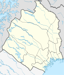
Koskullskulle is a place ( Tatort ) in the northern Swedish province of Norrbotten County and the historic province of Lapland , north of the Arctic Circle . The place is named after the former Landshövding von Norrbotten County Georg Adolf Koskull (1780-1829).
The place in the municipality of Gällivare is about six kilometers northeast of Gällivare . It is connected to Gällivare by the state roads ( Länsväg ) BD 830, BD 831 and BD 860 . A branch line of the ore railway leads to Koskullskulle, but it is only used for freight traffic and almost exclusively by the LKAB mining company . The approximately 140-kilometer-long Linaälven , a tributary of Ängesån, flows through the village .
The population development of Koskullskulle is declining. After 1601 residents were counted in the village in 1960, the number of residents fell over 1196 (after a slight recovery in 1995) and 874 (2010) to 818 (2015).
Known residents
- Jan Boklöv (* 1966), ski jumper
- Göran Forsmark (born 1955), actor

