Malmberget
| Malmberget | ||||
|
||||
| State : | Sweden | |||
| Province (län): | Norrbotten County | |||
| Historical Province (landskap): | Lapland | |||
| Municipality : | Gällivare | |||
| Coordinates : | 67 ° 11 ′ N , 20 ° 39 ′ E | |||
| SCB code : | 8732 | |||
| Status: | Crime scene | |||
| Residents : | 1757 (December 31, 2015) | |||
| Area : | 1.88 km² | |||
| Population density : | 935 inhabitants / km² | |||
| Malmberget östra | ||||
|---|---|---|---|---|
| Coordinates : | 67 ° 10 ' N , 20 ° 41' E | |||
| SCB code : | 8730 | |||
| Status: | Crime scene | |||
| Residents : | 1625 (December 31, 2015) | |||
| Area : | 0.93 km² | |||
| Population density : | 1747 inhabitants / km² | |||
| List of perpetrators in Norrbotten County | ||||
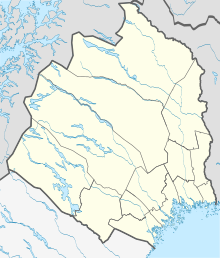
Malmberget ( Lule Málmmavárre; Meänkieli Malmivaara ) is a place in the Swedish province of County Norrbotten and the historical province of Lapland , about 70 km north of the Arctic Circle .
Geography and history
The town in the municipality of Gällivare is mainly known for its iron ore mines . Iron ore was quarried here for the first time in 1741. After the ore railway from the Baltic Sea port of Luleå to the pits was completed in 1888 (1902/1903 also to the year-round ice-free Narvik on the Atlantic ), a so-called “ore rush” began, comparable to the gold rush in North America. In the first few years the miners lived in huts that they had built from empty dynamite boxes.
A 250-meter-deep pit runs through Malmberget, dividing the place into two parts. Buildings and paths are continuously being torn down as they end up in the area with a risk of collapse. In 1974 a church was moved from the edge of the pit to the interior of the pit, which had been freed of ore. The number of inhabitants has decreased significantly in the last few decades. The expansion of the danger zone is also one of the main reasons for this. So people began to be relocated to Gällivare , three kilometers to the south , which is now larger than the original main town of Malmberget.
The now undeveloped strip between the two districts is about 500 meters wide, so that the Statistiska centralbyrån 2015 for the first time identified two separate perpetrators . The slightly more populous western part, in which most of the public facilities are located, is still called Malmberget, the eastern part with the traditional district names Malmsta and Kilen is known as the place of the crime, Malmberget östra ("Malmberget East"). The population of both districts together is less than a third of the maximum from the 1970s.
There is a mine museum in Malmberget, which tells the history of local ore mining from the discovery of the deposits to the present day. An extraordinary mineral collection and a photo exhibition can also be viewed here.
sons and daughters of the town
- Harry Åhman (1912–1992), correspondence chess master and a chess organizer
- Kurt Andersson (* 1939), national ice hockey and soccer player
- Göran Forsmark (1955-2020), Swedish actor
- Jan Boklöv (* 1966), ski jumper
- Olle Martinsson (* 1944), ski jumper
- Åsa Regnér (* 1964), politician
Varia
Malmberget is the location of the 44th chapter of Selma Lagerlöf's novel The Wonderful Journey of Little Nils Holgersson with the Wild Geese .

