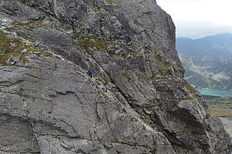
Kozia Przełęcz
| Kozia Przełęcz | |||
|---|---|---|---|
|
Orla Perć mountain trail on the pass |
|||
| Compass direction | west | east | |
| Pass height | 2159 m npm | ||
| Podhale , Powiat Tatrzański , Lesser Poland , Poland | Podhale , Powiat Tatrzański , Lesser Poland , Poland | ||
| Valley locations | Zakopane | Bukowina Tatrzańska | |
| Mountains | High Tatras , Tatras , Carpathians | ||
| map | |||
|
|
|||
| Coordinates | 49 ° 13 '10 " N , 20 ° 1' 30" E | ||
The Kozia Przełęcz ( German "Ziegenpass" or "Koziascharte") is a mountain pass in the south of the Polish Lesser Poland Voivodeship in the High Tatras . The pass lies on the border of the municipalities of Zakopane and Bukowina Tatrzańska on the eastern ridge of the Seealmspitze massif and connects the Dolina Kozia with the Dolina Pusta valley . The pass is 2137 m above sea level and borders the Ödkarturm ( Zamarła Turnia ) and Gemsenbastei ( Kozie Czuby ) peaks .
tourism
▬ The red marked high trail Orla Perć leads over the pass.
▬ A yellow marked hiking trail leads over the pass from the Fünfseental to the Seealmtal .
First ascent
It was ascended by Szymon Tatar for the first time in a documented document around 1860 .
literature
- Zofia Radwańska-Paryska, Witold Henryk Paryski, Wielka encyklopedia tatrzańska , Poronin, Wyd. Górskie, 2004, ISBN 83-7104-009-1 .
- Tatry Wysokie słowackie i polskie. Mapa turystyczna 1: 25.000, Warszawa, 2005/06, Polkart ISBN 83-87873-26-8 .

