Orla Perć
| Orla Perć | |
|---|---|
 Map of the way |
|
| Data | |
| length | ~ 4.5 km |
| location | High Tatras , Tatra Mountains , Poland |
| Markers | White-red-white |
| Starting point | Zawrat saddle 49 ° 13 ′ 8.8 ″ N , 20 ° 0 ′ 59.1 ″ E |
| Target point | Krzyżne saddle 49 ° 13 ′ 43.3 ″ N , 20 ° 2 ′ 50.4 ″ E |
| Type | Höhenweg |
| The highest point | 2291 m ( Kozi Wierch ) |
| Level of difficulty | heavy |
| season | Preferably in summer |


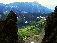
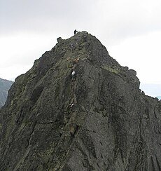
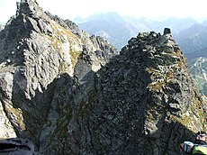
Orla Perć ( German Eagle Path ) is a high trail in the High Tatras in Poland . It is considered the most difficult hiking trail in the Tatra Mountains and in all of Poland. It is also the longest ridge trail in the High Tatras. Its length is 4.5 km and it usually takes six to eight hours to complete the route. It runs along the north ridge of the Świnica . Since 1906, more than 140 people have died on it. The most common reasons for this were slips and falls on the damp granite . For this reason, some sections of the route can only be accessed in one direction for some time. It is marked in red throughout.
Location and route
The trail is in the center of the High Tatras . Starting at the Zawrat saddle ( 2159 m npm ), the Orla Perć leads along the ridge over numerous peaks - the highest point is the Kozi Wierch at 2291 m npm - and finally ends at the Krzyżne saddle ( 2112 m npm ). The path is secured in places with chains , ladders and brackets. Several paths cross the Orla Perć, these lead to Zakopane and to two mountain huts, the Murowaniec Hut and the Five Polish Lakes Hut in the adjacent valleys Dolina Gąsienicowa and Dolina Pięciu Stawów Polskich . There is a risk of avalanches and falling rocks .
course
Upstream of the Orla Perć is the path from the Świnica down to the Zawrat mountain pass, which leads over or on the following peaks or mountain passes:
- Świnica peak (Seealmspitze, 2301 m),
- Świnicka Szczerbina Wyżnia mountain pass (Upper Seealmkerbe),
- Świnicka Kopa (Seealmkoppe) peak ,
- Gąsienicowa Przełączka mountain pass (Obere Seealmscharte, 2265 m),
- Peak Gąsienicowa Turnia (Upper Seealmturm, 2280 m),
- Niebieska Przełączka Wyżnia mountain pass (Obere Niebieskascharte),
- Summit Niebieska Turnia (Middle Seealmturm, 2262 m),
- Niebieska Przełęcz mountain pass (Niebieskascharte, 2225 m),
- Peak Zawratowa Turnia (Low Seealmturm, 2245 m)
- Zawrat mountain pass (Riegelscharte, 2159 m),
The path is accessible in both directions.
Zawrat-Kozi Wierch
The first section of the Orla Perć leads from the Zawrat mountain pass to the Kozi Wierch peak via or to the following peaks and mountain passes:
- Zawrat (2159 m),
- Mały Kozi Wierch peak (Kleiner Gemsenberg, 2226 m)
- Przełęcz Schodki mountain pass (Kegelsattel, 2065 m),
- Peak Kołowa Czuba (cone, 2105 m),
- Zmarzła Przełączka Wyżnia mountain pass (Upper Ödkarscharte),
- Peak Zmarzłe Czuby (Frozen waves),
- Zmarzła Przełęcz mountain pass (Ödkarscharte, 2126 m),
- Peak Zamarła Turnia (Ödkarturm, 2179 m),
- Kozia Przełęcz mountain pass (Gemsenscharte, 2137 m),
- Summit Kozie Czuby (Gemsenbastei, 2266 m),
- Kozia Przełęcz Wyżnia mountain pass (Obere Gemsenscharte, 2240 m),
- Summit Kozi Wierch (Gemsenberg, 2291 m).
Since July 2007, the path has only been accessible in one direction, namely from Zawrat to Kozi Wierch.
Kozi Wierch-Skrajny Garnet
The second section of Orla Perć leads from the Kozi Wierch peak to the Skrajny Granat peak via or to the following peaks and mountain passes:
- Summit Kozi Wierch (Gemsenberg, 2291 m).
- Kozi Mur mountain pass (chamois wall),
- Summit Buczynowa Strażnica ( beech observatory , 2242 m),
- Przełączka nad Dolinką Buczynową mountain pass (Schwarzwandscharte, 2225 m),
- Peak Czarne ściany (black wall, 2242 m),
- Zadnia Sieczkowa Przełączka mountain pass (Rear Sieczka Pass, 2194 m),
- Summit Zadnia Sieczkowa Turnia (Rear Sieczka Tower, 2222 m)
- Wyżnie Sieczkowe Siodełko mountain pass (Upper Sieczka Saddle, 2217 m),
- Summit Skrajna Sieczkowa Turnia (Front Sieczka Tower, 2226 m)
- Niżnie Sieczkowe Siodełko mountain pass (Lower Sieczka Saddle, 2199 m),
- Summit Pośrednia Sieczkowa Turnia (Middle Sieczka Tower, 2205 m)
- Sieczkowa Szczerba mountain pass (Sieczka-Scharte, 2215 m),
- Zadni Granat summit (southern Granatenspitze, 2240 m),
- Pośrednia Sieczkowa Przełączka mountain pass (Middle Sieczka Pass, 2218 m),
- Pośredni Granat peak (Middle Granatenspitze, 2234 m),
- Skrajna Sieczkowa Przełączka mountain pass (Front Sieczka Pass, 2197 m),
- Skrajny Granat summit (Northern Grenade Point , 2225 m).
The path is accessible in both directions.
Skrajny Garnet – Krzyżne
The third section of the Orla Perć leads from the Skrajny Granat peak to the Krzyżne mountain pass over or to the following peaks and mountain passes:
- Skrajny Granat peak (Northern Granatenspitze, 2225 m),
- Granacka Przełęcz mountain pass (Granatenscharte, 2145 m),
- Summit Wielka Orla Turniczka (Great Eagle Tower, 2160 m),
- Orla Przełączka Wyżnia mountain pass (Obere Adlerscharte),
- Peak Mała Orla Turniczka (Little Eagle Tower),
- Orla Przełączka Niżnia mountain pass (Lower Eagle Gap ),
- Orla Baszta summit (Adlerbastei, 2175 m),
- Pościel Jasińskiego Mountain Pass (Jasiński Scharte, 2125 m),
- Summit Buczynowe Czuby ( beech valley humps ),
- Przełęcz Nowickiego mountain pass (Nowicki-Scharte, 2105 m),
- Budzowa Igła peak ,
- Budzowa Przełączka mountain pass (Beech Valley notch ),
- Summit Wielka Buczynowa Turnia (Great Beech Valley Tower , 2184 m),
- Buczynowa Przełęcz mountain pass (Buchentalscharte, 2127 m),
- Peak Mała Buczynowa Turnia (Small Beech Valley Tower , 2172 m),
- Wyżnia Przełączka pod Ptakiem mountain pass (Kleine Buchentalscharte, 2125 m),
- Ptak summit (Vogel, 2135 m),
- Przełączka pod Ptakiem mountain pass (Vogelscharte, 2105 m),
- Summit Kopa nad Krzyżnem (cross Koppe, m 2135)
- Krzyżne mountain pass (cross saddle, 2112 m).
The path is accessible in both directions.
Wołoszyn
The fourth section of Orla Perć led from the Krzyżne mountain pass over the Wołoszyn massif over or to the following peaks and mountain passes:
- Krzyżne (Kreuzsattel, 2112 m),
- Peak Mały Wołoszyn (Little Wallachenkopf, 2144 m),
- Wołoszyńska Szczerbina mountain pass (Wallachensattel, 2141 m),
- Wielki Wołoszyn peak (Great Wallachenkopf, 2151 m),
- Wyżnia Wołoszyńska Przełęcz mountain pass (Upper Wallachensattel, 2061 m),
- Pośredni Wołoszyn summit (Middle Wallachenkopf, 2117 m),
- Niżnia Wołoszyńska Przełęcz mountain pass (Lower Wallachensattel, 2036 m),
- Skrajny Wołoszyn summit (Vorderer Walachenkopf, 2092 m),
- Summit Wierch nad Zagonnym Żlebem (Bankberg, 2037 m)
- Karbik mountain pass (notch, 989 m),
- Summit Turnia nad Dziadem (waterfall tower, 1901 m).
- Alm Polana pod Wołoszynem (Walachenwiese)
The fourth section was closed in 1932 and has now grown over. The area is a strictly protected nature reserve.
Accesses
Numerous access roads lead to the Orla Perć. They lead from the side:
- of Kasprowy Wierch and Świnica
- ▬ an access route marked in red, partially secured with chains, 2:25 h;
- of the Dolina Gąsienicowa valley from the Murowaniec hut
- ▬ a blue-marked access path to the Zawrat mountain pass, partially secured with chains, 2:20 h;
- ▬ a yellow-marked access path to the Kozia Przełęcz mountain pass, secured with chains , 2 hours;
- ▬ a black-marked access route over the Rysa Zaruskiego and the Żleb Kulczyńskiego , secured with chains with clamps and barriers, 2:30 h;
- ▬ a green secured access path between the Zadnia Sieczkowa Przełączka mountain passand the Zadni Granat peak, without security, 2:30 h
- ▬ a yellow-marked access path below the Skrajny Granat , without safety, 2:25 h;
- ▬ a yellow-marked access path through the Dolina Pańszczyca valleyto the Krzyżne mountain pass, without security, 2:45 h
- of the Dolina Pięciu Stawów Polskich valley from the Five Polish Lakes Hut
- ▬ a blue-marked access path to the Zawrat mountain pass, without security, 1:40 h;
- ▬ a yellow-marked access path to the Kozia Przełęcz mountain pass, secured with chains with brackets, 1:50 h;
- ▬ a black-marked access path to Kozi Wierch , without security, 1:55 h;
- ▬ a yellow marked access route to the Krzyżne mountain pass, without security, 2:05 h.
history
The Polish poet Franciszek Henryk Nowicki had the idea of building a path here . On February 5, 1901, he wrote a letter to the Polish Tatra Society with the suggestion of creating a hiking trail from the Wodogrzmoty Mickiewicza waterfall over the Wołoszyn, Krzyżne, Granaty, Kozi Wierch and on to the Zawrat. Here the hiking trail should meet the existing ridge path from Zawrat to Świnica , Kasprowy Wierch , Czerwone Wierchy to the Dolina Kościeliska valley . The path was built by the Polish Tatra Society and pastor Walenty Gadowski between 1903 and 1906, the accesses were built between 1904 and 1991. Many góralen , such as Jakub Gąsienica Wawrytko and Klemens Bachleda , participated in the construction. The approach from Zmarzły Staw Gąsienicowy was opened in 1912, closed in 1925 and reopened in 1953.
The first winter ascent of the section on Wołoszyn was on December 31, 1932 by Witold Henryk Paryski and Tadeusz Pawłowski . Zbigniew Jaworowski and Andrzej Manda completed the first complete winter ascent on April 17th and 18th, 1949.
After some serious accidents in 2006, it was proposed to close the path and turn it into a via ferrata . The mountain rescue service TOPR requested the dismantling of all chains and other safety devices in order to close the path for all non-alpinists. It was argued that alpinists do not need these safety devices and that non-alpinists should not use the high trail. Finally it was decided to leave the route unchanged as a historical route. Since July 2007, the ascent of Orla Perć on the section from Zawrat saddle to Kozi Wierch has only been possible in one direction, with a short section that can be walked in both directions.
Culture
In the song Orla Perć the musician Roman Kołakowski dealt with the balancing act of pastor Józef Tischner's philosophy .
See also
- Lenin way
- Ceprostrada
- Oswald-Balzer-Weg
- Droga po Głazach
- Brother Albert Way
- Droga pod Reglami
- Ścieżka nad Reglami
- Sokola Perć
- Tourism in Poland
swell
- ↑ wgorach.com: Adam Marasek: Tatry - Orla Perć Wypadki i akcje ratownicze 1909-2004 ( Memento of the original from March 13, 2016 in the Internet Archive ) Info: The archive link was inserted automatically and has not yet been checked. Please check the original and archive link according to the instructions and then remove this notice. , (Polish)
- ↑ orlaperc.info.pl: Juliusz Wysłouch: Via ferraty dla tatr Wysokich , "Na szlaku" 10/2003 , (Polish) (accessed on November 25, 2009)
- Zofia Radwańska-Paryska, Witold Henryk Paryski: Wielka encyklopedia tatrzańska. Wyd. Górskie, Poronin 2004, ISBN 83-7104-009-1 .
- Tatry Wysokie słowackie i polskie. Mapa turystyczna 1: 25,000, Polkart, Warszawa 2005/06, ISBN 83-87873-26-8 .
Web links
- Orla Perć on summitpost.org (English)


