Kröbern
|
Kröbern
Monstab parish
Coordinates: 51 ° 0 ′ 1 ″ N , 12 ° 21 ′ 10 ″ E
|
||
|---|---|---|
| Height : | 187–202 m above sea level NN | |
| Area : | 1.35 km² | |
| Residents : | 20 (2012) | |
| Population density : | 15 inhabitants / km² | |
| Incorporation : | July 1, 1950 | |
| Postal code : | 04617 | |
| Area code : | 034498 | |
|
Location of Kröbern in Thuringia |
||
|
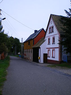
Town center
|
||
Kröbern is a hamlet of Monstab in the Altenburger Land district in Thuringia .
location
Kröbern is located west of Altenburg in the Zeitzer-Altenburger-Lösshügelland , a branch of the Leipzig lowland bay with very good soils. The federal highway 180 passes to the east.
history
The first documentary mention of the hamlet took place in the period from 1181 to 1214. Burgrave Albrecht IV of Altenburg transferred the Burgkorn in the village of Kröbern to the Buch monastery in 1305 . Later the place belonged to the Wettin office of Altenburg , which from the 16th century was under the sovereignty of the following Ernestine duchies due to several divisions in the course of its existence : Duchy of Saxony (1554 to 1572), Duchy of Saxony-Weimar (1572 to 1603), Duchy of Saxony -Altenburg (1603 to 1672), Duchy of Saxony-Gotha-Altenburg (1672 to 1826). When the Ernestine duchies were reorganized in 1826, the place again became part of the Duchy of Saxony-Altenburg. After the administrative reform in the duchy, Kröbern belonged to the eastern district (until 1900) and to the Altenburg district office (from 1900). From 1918 the village belonged to the Free State of Saxony-Altenburg , which was added to the State of Thuringia in 1920. In 1922 the place came to the district of Altenburg .
Lignite mining around the south of the Meuselwitz-Altenburg lignite mining area in Kröbern began around 1900. Underground pits were "Grube Gertrud No. 131" (1899 to 1959) in the northwest of the village and "Grube Neu- Rositz No. 145" (1917 to 1942) in the northeast . The brown coal mining in the open pit brought great changes for the place. Between 1914 and 1932 the "Gertrud II open-cast mine" (also: Petsa open-cast mine) destroyed the area south and west of Kröbern, so that there was now an open-cast mine between Monstab and Kröbern. The opencast mine Gertrud III (Zechau) , which opened in 1931, brought even bigger cuts , which dredged a large area in the north from Kröbern to Zechau until 1959 and did not spare the neighboring towns of Petsa (1943 to 1947) and Leesen (1950 to 1952). The area was renatured after the closure of the opencast mine in 1959 and then used for agriculture.
On July 1, 1950, the hamlet of Kröbern was incorporated into Monstab. In the 1980s, the resumption of lignite mining was planned, but this was not carried out. The local area of Kröbern, on the south-eastern edge of which it was located, should have given way to the planned “Meuselwitz opencast mine” between Meuselwitz and Rositz .
Web links
Individual evidence
- ^ Wolfgang Kahl: First mention of Thuringian towns and villages. A manual. Verlag Rockstuhl, Bad Langensalza 2010, ISBN 978-3-86777-202-0 , p. 154
- ^ History of the Burgraves of Altenburg, p. 58
- ^ The Altenburg Office in the book "Geography for all Stands", from p. 201
- ^ The locations of the Altenburg district from p. 83
- ↑ The eastern district of the Duchy of Saxony-Altenburg in the municipal directory 1900
- ^ The Altenburg district office in the municipality register 1900
- ↑ Description of the Zechau opencast mine in a PDF document from the LMBV
- ↑ The Altenburg / Meuselwitz lignite district, LMBV publication


