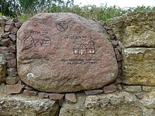
Zechau
|
Zechau
community Kriebitzsch
Coordinates: 51 ° 0 ′ 45 ″ N , 12 ° 20 ′ 2 ″ E
|
||
|---|---|---|
| Height : | 230 m above sea level NN | |
| Residents : | 100 (2012) | |
| Incorporation : | August 1, 1977 | |
| Postal code : | 04617 | |
| Area code : | 034498 | |
|
Location of Zechau in Thuringia |
||
|
In the town
|
||
Zechau is a district of Kriebitzsch in the Altenburger Land district in Thuringia . From 1923 until the demolition of the districts in the 1940s and 1950s, Zechau was the main town of the Zechau-Leesen community .
location
Zechau is located south of Kriebitzsch on the edge of the Leipzig lowland bay and at the transition to the overgrown Zeitzer and Schmöllner hill country . The state road 1361 leads to the west and the federal road 180 to the east. To the west of Zechau is the Restloch Zechau nature reserve , a remnant of the Zechau open-cast lignite mine , to which the Petsa and Leesen districts fell victim.
history
Zechau was first mentioned in the tithe index of the Posa monastery dating from 1181 to 1214 . The place belonged to the Wettin office of Altenburg , which was under the sovereignty of the following Ernestine duchies from the 16th century due to several divisions in the course of its existence : Duchy of Saxony (1554 to 1572), Duchy of Saxony-Weimar (1572 to 1603), Duchy of Saxony- Altenburg (1603 to 1672), Duchy of Saxe-Gotha-Altenburg (1672 to 1826). When the Ernestine duchies were reorganized in 1826, the place came back to the duchy of Saxony-Altenburg. After the administrative reform in the Duchy of Saxony-Altenburg, the place belonged to the Eastern District (until 1900) and to the Altenburg District Office (from 1900). From a legal point of view, the village was under the Altenburg District Court since 1879 and the Meuselwitz District Court from 1906 . From 1918 Zechau belonged to the Free State of Saxony-Altenburg , which in 1920 was incorporated into the State of Thuringia . In 1922 the place was incorporated into the Altenburg district. Zechau, Leesen and Petsa merged in 1923 to form the municipality of Zechau-Leesen.
Lignite mining around Zechau, located in the south of the Meuselwitz-Altenburg lignite mining area , began in the second half of the 19th century. Underground pits were "Grube Ida No. 108" (1878 to 1952) in the north of the village, "Grube Baunack No. 83" (1867 to 1876) in the northeast, and "Grube Gertrud No. 131" (1899 until 1959) and in the southwest the "Eugen Pit No. 132" (1900 to 1960). In 1898 the Zechau-Kriebitzscher coal works “Glückauf”, based in Zechau, was created through the merging of the Gertrud shaft with the Glückauf shaft near Kriebitzsch. In addition, the Gertrud briquette factory was opened, which, like the in-house sugar factory, was supplied with raw coal from civil engineering. It was in operation until 1991.
In the open-cast mine , the coal was initially mined in the "Tagebau Eugen" (1911 to 1915) to the southwest of Zechau and the "Tagebau Gertrud I" (1908 to 1916) to the northwest. The "Gertrud II (Petsa) opencast mine" (1914 to 1932) south of Petsa followed a little later. The opencast mine Gertrud III (Zechau) , which was opened in 1931 , gradually approached the community of Zechau-Leesen from the southeast. After the fulcrum was moved to the north of Petsa in 1943/44, the 350 residents of the Petsa district were largely relocated to a district in Kriebitzsch that was built especially for the residents by 1947. Between 1950 and 1952, this fate also struck the 1310 inhabitants of the Leesen district and part of Zechau, who were also resettled to Kriebitzsch. This was the largest mining-related relocation of settlements at the time. All graves in the Zechau-Leesen cemetery were reburied in Meuselwitz . After 1952, the Leesen corridor was dredged over. After the opencast mine on the western outskirts of Zechau came to a standstill in 1959 due to carbonization, the now renatured Zechau hole was created in the Leesen area. Today it is a nature reserve of great ecological importance within the mining landscape south of Leipzig. The former corridor of Petsa and the area south of Zechau devastated by the opencast mine is used for agriculture today.
On August 1, 1977, the only remaining district of Zechau of the former municipality of Zechau-Leesen was incorporated into Kriebitzsch. In the 1980s, the resumption of lignite mining was planned, but this was not carried out. The entire municipal area of Kriebitzsch, including the Zechau location and the area of the former Zechau opencast mine, should have given way to the planned “Meuselwitz opencast mine” between Meuselwitz and Rositz . In 2012, 100 people lived in the Zechau district.
Personalities
- Walter Libuda (born June 24, 1950 in Zechau-Leesen), German painter, draftsman, sculptor and object artist
Web links
- Description of the Zechau opencast mine in a PDF document from the LMBV
- Measuring table sheet 2875, Saxon No. 57: Meuselwitz, 1928
- Website about the "Gertrud" briquette factory in Zechau
Individual evidence
- ↑ Hans Patze (arrangement): Altenburger Urkundenbuch (976-1350), Jena 1955, no. 69a
- ^ The Altenburg Office in the book "Geography for all Stands" in the Google book search, from page 201
- ↑ The locations of the Altenburg district in the Google book search, from p. 83
- ↑ The eastern district of the Duchy of Saxony-Altenburg in the municipal directory 1900
- ^ The Altenburg district office in the municipality register 1900
- ^ Zechau-Leesen in the Thuringia archive portal
- ↑ The Altenburg / Meuselwitz lignite district, LMBV publication


