Kriebitzsch
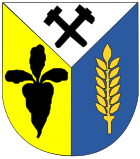
| coat of arms | Germany map | |
|---|---|---|

|
Coordinates: 51 ° 1 ′ N , 12 ° 20 ′ E |
|
| Basic data | ||
| State : | Thuringia | |
| County : | Altenburger Land | |
| Management Community : | Rositz | |
| Height : | 200 m above sea level NHN | |
| Area : | 13.29 km 2 | |
| Residents: | 1005 (Dec. 31, 2019) | |
| Population density : | 76 inhabitants per km 2 | |
| Postal code : | 04617 | |
| Primaries : | 03448, 034498 (Zechau) | |
| License plate : | ABG, SLN | |
| Community key : | 16 0 77 022 | |
| LOCODE : | DE KBT | |
| Community structure: | Core community; 2 districts | |
| Address of the municipal administration: |
Hauptstrasse 26 04617 Kriebitzsch |
|
| Website : | ||
| Mayor : | Bernd Burkhardt ( The Left ) | |
| Location of the municipality of Kriebitzsch in the Altenburger Land district | ||
Kriebitzsch is a municipality in the Altenburger Land district in Thuringia . It belongs to the administrative community Rositz .
geography
Geographical location
The community is assigned to the Altenburg-Zeitz loess hill country and is strongly influenced by the former lignite mining ( Meuselwitz-Altenburger lignite district ). The former Zechau opencast mine - located between Monstab , Großröda and the three districts of Kriebitzsch - today forms the "Restloch Zechau" nature reserve with great ecological importance in the mining landscape south of Leipzig . The main town of Kriebitzsch is only two kilometers from the nearest town of Meuselwitz . The district town of Altenburg is five kilometers southeast.
Neighboring communities
Adjacent communities are (clockwise) the city of Meuselwitz , Rositz , Monstab and Starkenberg in the Altenburger Land district and Elsteraue in the Burgenland district of Saxony-Anhalt .
Community structure
The districts of Altpoderschau and Zechau belong to Kriebitzsch . The former places Leesen and Petsa fell victim to brown coal mining ( Zechau opencast mine ) in the 1950s and were relocated.
history
Early history
In 1905, a Bronze Age hoard was unearthed in what was then the sand pit. In two clay vessels there were twelve eyelet neck rings, two open arm rings and a rim ax. It could have been a ritual dumping.
13th to 19th centuries
Kriebitzsch was first mentioned in documents in 1216. In the village, the construction of the St. Vitus Church was arranged on the instructions of Emperor Friedrich Barbarossa (1122–1190) . Kriebitzsch belonged to the Wettin office of Altenburg , which was under the sovereignty of the following Ernestine duchies from the 16th century due to several divisions in the course of its existence : Duchy of Saxony (1554 to 1572), Duchy of Saxony-Weimar (1572 to 1603), Duchy of Saxony-Altenburg (1603 to 1672), Duchy of Saxony-Gotha-Altenburg (1672 to 1826). When the Ernestine duchies were reorganized in 1826, the place came back to the duchy of Saxony-Altenburg. After the administrative reform in the Duchy of Saxony-Altenburg, Kriebitzsch belonged to the Eastern District (until 1900) and to the Altenburg District Office (from 1900). From a legal point of view, the village was under the Altenburg District Court since 1879 and the Meuselwitz District Court from 1906 .
Period of lignite mining in and around Kriebitzsch
Lignite mining around the Kriebitzsch in the center of the Meuselwitz-Altenburg lignite mining area began in the second half of the 19th century. With the Altenburg – Meuselwitz – Zeitz railway line, which opened in 1872 and at which Kriebitzsch received a train station, lignite mining experienced an upswing, as new sales markets could be opened up with the railway. In the period that followed, underground pits were built around the entire site. a. the "Grube Ida No. 108" (1878 to 1952), the "Grube Gertrud No. 131" (1899 to 1959), the "Grube Agnes No. 109" (1872 to 1952) and the "Grube Union No. 112" (1872 to 1952). In 1898 the Zechau-Kriebitzscher coal works “Glückauf”, based in Zechau, was created through the merging of the Gertrud shaft with the Glückauf shaft near Kriebitzsch. At times five briquette factories were in operation in Kriebitzsch .
In the open-cast mine , the coal was initially mined in the "Gertrud I open-cast mine" (1908 to 1916) to the southwest of Kriebitzsch. The "Gertrud II (Petsa) opencast mine" (1914 to 1932) south of Petsa followed a little later. The opencast mine Gertrud III (Zechau), which was opened in 1931 in the area of the municipality of Zechau-Leesen south of Kriebitzsch, dredged over the Petsa district between 1943 and 1947 and the Leesen district between 1950 and 1952. Most of the inhabitants were resettled in a specially built settlement in Kriebitzsch. After the opencast mine on the western outskirts of Zechau came to a standstill in 1959 due to carbonization, the now renatured Zechau hole was created in the Leesen area. Today it is a nature reserve of great ecological importance within the post-mining landscape south of Leipzig.
20th century
From 1918 on, Kriebitzsch belonged to the Free State of Saxony-Altenburg , which was added to the State of Thuringia in 1920. In 1922 the place was incorporated into the Altenburg district. At the time of National Socialism , the Deutsche Erdoel-Actiengesellschaft (DEA) maintained a camp with 96 forced laborers in Zechau , and 12 in Kriebitzsch who had to work in the brother mine H. Solf.
During the second district reform in the GDR in 1952, the existing states were dissolved and the districts were redesigned. Thus Kriebitzsch came with the district Altenburg to the district of Leipzig . In 1953 an LPG was founded. In the 1980s, the resumption of lignite mining was planned, but this was not carried out. The entire municipality of Kriebitzsch, including the districts of Altpoderschau and Zechau, should have given way to the planned “Meuselwitz opencast mine” between Meuselwitz and Rositz . In 1990 Kriebitzsch became Thuringian again with the Altenburg district, and since 1994 the place has belonged to the Altenburger Land district.
Incorporation and population development
Incorporations
Altpoderschau was incorporated on January 1, 1973 after it had been combined with Neupoderschau since 1957 to form the municipality of Poderschau. On August 1, 1977, Zechau was incorporated into the corridors of the former Leesen and Petsa .
Population development

The statistics give for Kriebitzsch without the later incorporated places 1910 1686, 1925 1900, 1933 1827 and 1939 still 1734 inhabitants.
Development of the population (as of December 31st) :
|
|
|
|
|
| Data source: Thuringian State Office for Statistics | ||||
politics
Municipal council
Since the local elections on May 25, 2014 , the local council has been composed as follows:
- DIE LINKE - 7 seats (57.7%)
- Free Community of Voters (FWG) - 3 seats (25.0%)
- Social Democratic Voters Association Kriebitzsch (SWV) - 2 seats (17.3%)
The turnout was 54.6%.
mayor
Lutz Kipping, a member of the electoral community, won the municipal council election of 1994 with 66.9% of the votes in the first ballot. In 1999 Bernd Burkhardt from the PDS prevailed with 58.3% in the first ballot. They were re-elected in the first ballot in 2004 (96.2%), 2010 (70.3%) and on June 5, 2016 (73.5%).
Economy and Infrastructure
traffic
The federal highway 180 runs from Altenburg to Zeitz via Kriebitzsch . The main road in 2174 leads to the winter village , county and township roads tap the two southern districts Altpoderschau and Zechau. The community is part of the Central German Transport Association and is directly connected to Altenburg, Meuselwitz and Lucka via several daily bus routes operated by the THÜSAC local passenger transport company . Line 412 runs to Leipzig. Kriebitzsch had a stop on the now disused railway line Zeitz-Altenburg .
Established businesses
There was a briquette factory in the Zechau district. It was built in 1898/1899 and remained in operation until 1991. The factory was partly used as a technical museum from mid-1993. However, the museum had to close and eventually the factory was completely demolished in 2003.
church
The hall church is in parts still Romanesque and has a polygonal closed choir. Five pointed arch windows were created in 1898 by the Wilhelm Franke workshop in Naumburg . The apex window shows Christ. In the quatrefoil the inscription after Lk2, 14; Glory to God in the highest. The choir windows sIII and sIV are framed with frame borders that close off the windows. Elaborately designed stained glass windows with decorative borders and dog roses as well as various lettering tapes. Domglas Naumburg is the successor company with archive documents.
Personalities
- Alban Köhler (born March 1, 1874 in Petsa, † February 26, 1947 in Niederselters ), radiologist
- Walter Libuda (born June 24, 1950 in Leesen), object artist
literature
- Lore-Christine Jaschke: Family book Kriebitzsch (district Altenburger Land) 1809-1875. Leipzig: AMF 2010 (= Central German local family books of the AMF 54)
Web links
Individual evidence
- ^ Population of the municipalities from the Thuringian State Office for Statistics ( help on this ).
- ↑ Areas of the post-mining landscape relevant to nature conservation ( Memento from October 6, 2007 in the Internet Archive )
- ↑ Nature and landscape protection areas in Altenburger Land
- ↑ Michael Köhler: Pagan sanctuaries . Jenzig-Verlag, 2007, ISBN 978-3-910141-85-8 , p. 192 .
- ^ The Altenburg Office. In: Geography for all stands , p. 201 ff.
- ^ The locations of the Altenburg district from p.83 .
- ↑ The eastern district of the Duchy of Saxony-Altenburg in the municipal directory 1900
- ^ The Altenburg district office in the municipality register 1900
- ↑ Thuringian Association of the Persecuted of the Nazi Regime - Association of Antifascists and Study Group of German Resistance 1933-1945 (ed.): Heimatgeschichtlicher Wegweiser to places of resistance and persecution 1933-1945, series: Heimatgeschichtliche Wegweiser Volume 8 Thüringen, Erfurt 2003, p. 20 , ISBN 3-88864-343-0
- ↑ The Altenburg / Meuselwitz lignite district, LMBV publication
- ↑ Results of the mayoral elections on the website of the Regional Returning Officer Thuringia , accessed on July 31, 2016.
- ↑ Technical Museum Zechau. In: Street of the brown coal. Retrieved October 14, 2012 .


