
Heukewalde
| coat of arms | Germany map | |
|---|---|---|

|
Coordinates: 50 ° 50 ′ N , 12 ° 16 ′ E |
|
| Basic data | ||
| State : | Thuringia | |
| County : | Altenburger Land | |
| Management Community : | Upper Sprottental | |
| Height : | 275 m above sea level NHN | |
| Area : | 5.9 km 2 | |
| Residents: | 187 (Dec. 31, 2019) | |
| Population density : | 32 inhabitants per km 2 | |
| Postal code : | 04626 | |
| Area code : | 034496 | |
| License plate : | ABG, SLN | |
| Community key : | 16 0 77 016 | |
| Address of the municipal administration: |
Dorfstrasse 30 04626 Heukewalde |
|
| Website : | ||
| Mayor : | Maik Piewak | |
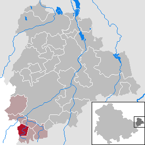
| Location of the municipality of Heukewalde in the Altenburger Land district | ||
  |
||

.jpg)

Heukewalde is a municipality in the south of the Thuringian district of Altenburger Land . It belongs to the administrative community of Upper Sprottental .
geography
Geographical location
Heukewalde is part of the Ronneburg arable and mining area . The village is traversed from south to north by the Heukewalder Sprotte, which flows into the Mannichswalder Sprotte between Vollmershain and Posterstein . The nearest towns are Ronneburg (7 km northwest), Schmölln (9 km northeast) and Crimmitschau (9 km east).
Neighboring communities
Neighboring communities are Jonaswalde , Posterstein and Vollmershain in the Altenburger Land district and Rückersdorf and Paitzdorf in the Greiz district .
history
The place was first mentioned in a document on December 9th, 1152. The place represents a typical street village three and a half kilometers in length and can therefore be recognized as a German foundation. The townscape is mainly shaped by the typical Altenburg half-timbered courtyards. From 1826 to 1918 Heukewalde belonged to the Duchy of Saxony-Altenburg , then until May 1, 1920, to the Free State of Saxony-Altenburg , which then became part of Thuringia . On October 1, 1922, the place came to the district of Gera , as the district office of Ronneburg was divided, to which Heukewalde had belonged since April 1, 1900. In 1952, Heukewalde went to the Schmölln district .
Population development
In 1910 Heukewalde had 322 inhabitants, in 1933 there were 256 and in 1939 245 inhabitants.
Development of the population (from 1994: as of December 31) :
|
|
|
|
|
- Data source from 1994: Thuringian State Office for Statistics
politics
Municipal council
Since the local elections on May 25, 2014 , the local council has been composed as follows:
- CDU voter group: 2 seats (37.3%)
- Independent: 2 seats (36.8%)
- Voluntary fire brigade : 2 seats (26.0%)
The turnout was 86.9% (+ 9.5% p).
mayor
In the 1994 mayoral election, Lutz Wolf from the CDU received 88.5% of the valid votes in the first ballot. In 1999 he was confirmed in office with 86.9% of the votes in the first ballot. In 2004, the independent Maik Piewak was elected mayor in the first ballot with 80.5% of the vote. In 2010 he again prevailed against the CDU candidate in the first ballot with 62.0% of the vote. He won the election on June 5, 2016 with no opposing candidates with a majority of 75.2% and a voter turnout of 85.3% (- 6.8% p).
coat of arms
Description of the coat of arms : "Divided into three parts with a grafted flat silver tip , a red- armored black eagle at the gap in gold above, a golden wheat ear in red above and a red heraldic rose in silver below ."
The eagle stands for the former legal immediacy of the area around Heukewalde. The ear of wheat illustrates the agricultural character of the community. The red rose stands for belonging to the Burggrafschaft Altenburg . The church colors are gold and red.
Culture and sights

- see also: List of cultural monuments in Heukewalde
The center of the village is a country inn with a guesthouse, which has a citizens' hall and a bowling alley. There are a total of four guesthouses and several hiking trails to nearby attractions in the village. The church is also a sight .
Economy and Infrastructure
Heukewalde is on the county road K 502 with the neighboring towns Nischwitz and Posterstein connected. Another local connecting road leads to Jonaswalde . The community is part of the Central German Transport Association and is connected to the bus routes 355 Schmölln - Untschen - Thonhausen and 357 Schmölln - Selka - Weißbach - Brandrübel - Schönhaide - Thonhausen - Nischwitz of the THÜSAC local passenger transport company , which run on weekdays except Saturdays . The next train station is in Nöbdenitz, four kilometers to the north .
Personalities
- Johannes Brumme (born August 6, 1909 in Heukewalde; † September 23, 1967), educator, anti-fascist resistance fighter, former concentration camp prisoner, school reformer and university professor
Web links
Individual evidence
- ^ Population of the municipalities from the Thuringian State Office for Statistics ( help on this ).
- ↑ Heukewalde.de
- ^ A b Register of municipalities in Germany 1900 - Duchy of Saxony-Altenburg - Ronneburg district office. Retrieved September 25, 2012 .
- ↑ 2014 municipal council elections , accessed on August 4, 2014.
- ↑ Results of the mayoral election on the website of the Regional Returning Officer Thuringia , accessed on August 1, 2016
Altenburg | Dobitschen | Fockendorf | Gerstenberg | Goehren | Göllnitz | Göpfersdorf | Gößnitz | Haselbach | Heukewalde | Heyersdorf | Jonaswalde | Kriebitzsch | Langenleuba-Niederhain | Löbichau | Lödla | Lucka | Mehna | Meuselwitz | Monstrous | Nobitz | Ponitz | Poster stone | Rositz | Schmölln | Starkenberg | Thonhausen | Treben | Vollmershain | Windischleuba