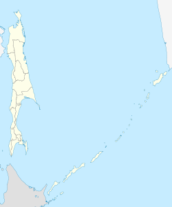
Krasnogorsk (Sakhalin)
| Village
Krasnogorsk
Красногорск
|
||||||||||||||||||||||||||||||||||
|
||||||||||||||||||||||||||||||||||
|
||||||||||||||||||||||||||||||||||
Krasnogorsk ( Russian Красногорск ) is a village (until 2004 city) in Sakhalin Oblast ( Russia ) with 2969 inhabitants (as of October 14, 2010).
geography
The village is situated on the west coast of Sakhalin Island Sakhalin , about 170km (distance) northwest of the Oblasthauptstadt Yuzhno-Sakhalinsk . The place belongs to Rajon Tomari , whose administrative center, the city of Tomari , is 80 kilometers away in a southerly direction.
Krasnogorsk is in a flat, from spits formed coast section at the mouth of the river and Krasnogorka Ainskaja. North of Krasnogorsk lies the approximately 20 km² large lagoon-like , Ainskaya-fed Ainskoje Lake (Russian for “ Ainu Lake ”).
history
The place that arose around the turn of the 20th century not far from the Ainu settlement Raitisi was called Mihama-Mura as a municipality together with two other nearby villages from 1922 , and from 1938 Chinnai ( Japanese 珍 内 町 , - chō ), derived from the Ainu -Words for "valley in mountainous area". When Sakhalin after the Treaty of Portsmouth , which ended the Russo-Japanese War 1904-1905, belonged to Japan. As a result of the Second World War , the city came back to the Soviet Union and received Soviet town charter in 1947 under its current name.
After the population had decreased continuously since the 1950s and significantly in the 1990s, Krasnogorsk lost its city status in 2004 and has been a rural settlement ever since.
Population development
| year | Residents |
|---|---|
| 1897 | 15th |
| 1925 | 1,540 |
| 1935 | 3,218 |
| 1941 | 15,430 |
| 1959 | 8,592 |
| 1970 | 6,969 |
| 1979 | 5,868 |
| 1989 | 5,502 |
| 2002 | 3,611 |
| 2010 | 2,969 |
Note: census data
Economy and Infrastructure
There are forest and agricultural holdings in Krasnogorsk.
The regional road R495 runs through the village , which runs along the west coast of Cholmsk in a northerly direction via Uglegorsk and Lessogorskoje to Boschnjakowo . The closest train station on Sakhalin's narrow-gauge network ( Cape gauge 1067 mm) is Ilyinsk , about 50 kilometers south.
Individual evidence
- ↑ a b Itogi Vserossijskoj perepisi naselenija 2010 goda. Tom 1. Čislennostʹ i razmeščenie naselenija (Results of the All-Russian Census 2010. Volume 1. Number and distribution of the population). Tables 5 , pp. 12-209; 11 , pp. 312–979 (download from the website of the Federal Service for State Statistics of the Russian Federation)
- ↑ ak.gks.ru ( Memento from June 6, 2013 in the Internet Archive ) /
- ↑ kindai.ndl.go.jp ( Memento from February 7, 2016 in the Internet Archive )
- ↑ kindai.ndl.go.jp ( Memento from March 4, 2016 in the Internet Archive )
- ↑ demoscope.ru
- ↑ demoscope.ru
- ↑ demoscope.ru
- ↑ demoscope.ru
Web links
- Krasnogorsk on mojgorod.ru (Russian)


