Kreuzspitze (Schobergruppe)
| Cross point | ||
|---|---|---|
|
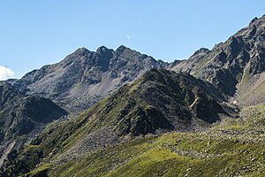
Kreuzspitze from the southeast |
||
| height | 2937 m above sea level A. | |
| location | Tyrol , Austria | |
| Mountains | Schobergruppe | |
| Coordinates | 46 ° 56 '10 " N , 12 ° 40' 4" E | |
|
|
||
| First ascent | L. Patera (1902) | |
| Normal way | From the Hochschoberhütte to the Zilinschartl and over the east ridge ( II ). | |
The Kreuzspitze is 2937 m above sea level. A. high mountain peaks of the Schober group in East Tyrol ( Austria ). The remote, rarely visited summit was first climbed on July 26, 1902 by L. Patera .
location
The Kreuzspitze is located at the end of the Hochschober-Westkamm in the far west of the Schobergruppe on the municipality border between Kals am Großglockner in the north and St. Johann im Walde in the south. The summit consists of the east summit, a middle summit and the western tower. The three peaks extend between the Riegelkopf ( 2713 m above sea level ) in the northwest and the western summit of the Leibnitzer Rotspitzen ( 2979 m above sea level ) in the northeast. The southwest ridge of the Kreuzspitze leads to the Obere Tor ( 2755 m above sea level ), and to the south-east is the Zutrugenspitze ( 2662 m above sea level ). To the north of the Kreuzspitze are the headwaters of the Staniskabach and the Staniskaalm, to the south the slopes of the Kreuzspitze fall into the valley of the Leibnitzbach , where the Leibnitzalm is located. The closest refuge is the Hochschoberhütte , located southeast in the Leibnitz Valley . The closest village is Oberleibnig (municipality of St. Johann im Walde).
Promotion opportunities
The normal route to the Kreuzspitze leads from the Hochschoberhütte initially briefly marked to the north. In the area of a moraine wall, the ascent branches off to the west and leads into the cirque between Kleines Schöberl and Zilinkopf . The insignificant Zilinschartl can then be reached from the cirque. From the Zilinschartl, the ascent continues into the Zutrugenkar. Over the Zutrugenkar you come in a north-westerly direction to a steep, ridge-riddled slope that leads to the lowest point east of the Kreuzspitze. The east summit is easy to get to via the east ridge. The continuation to the middle summit requires climbing experience ( II ) due to the deep recess . The western tower can only be climbed over a gap.
Individual evidence
literature
- Walter Mair: Alpine Club Leader Schobergruppe. Bergverlag Rudolf Rother: Munich 1972, ISBN 3-7633-1222-6 .
- Alpine Club Map 1: 25,000, sheet 41, Schobergruppe , ISBN 978-3-928777-12-4

