Upper body
|
Oberleibnig (village) cadastral community St. Johann im Walde |
||
|---|---|---|
|
|
||
| Basic data | ||
| Pole. District , state | Lienz (LZ), Tyrol | |
| Pole. local community | St. Johann in the forest | |
| Coordinates | 46 ° 54 '47 " N , 12 ° 38' 12" E | |
| height | 1244 m above sea level A. | |
| Residents of the stat. An H. | 93 (1981) | |
| Area d. KG | 32.82 km² | |
| Post Code | 9952 | |
| prefix | + 43/04872 | |
| Statistical identification | ||
| Cadastral parish number | 85031 | |
| Counting district / district | St. Johann im Walde (70 725 000) | |
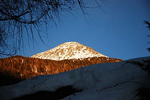
 View of the Leibniger Tor (local mountain) |
||
| Source: STAT : index of places ; BEV : GEONAM ; TIRIS | ||
Oberleibnig is a fraction of the municipality of St. Johann im Walde in East Tyrol. The village is located on the eastern side of the Isel valley at an altitude of 1,244 meters and can be reached from Felbertauern Straße via the districts of Oblassberg and Gwabl (municipality of Ainet ). In Oberleibnig there is the listed Maria Schnee chapel from the 17th century.
The local mountain of Oberleibnig is the Leibniger Tor with a height of 2515 meters.
