Karlkamp
| Karlkamp | ||
|---|---|---|
|
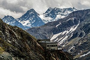
Alwitzsch, Hoher Bretterkopf, Hoher Seekamp and Karlkamp (from left to right) |
||
| height | 3114 m above sea level A. | |
| location | Carinthia , Austria | |
| Mountains | Schobergruppe | |
| Dominance | 3.5 km → Großer Hornkopf | |
| Notch height | 273 m ↓ Brentenscharte | |
| Coordinates | 46 ° 59 '49 " N , 12 ° 48' 2" E | |
|
|
||
| rock | Amphibolite , eclogite , mica slate to paragneiss | |
| First ascent | October 3, 1890 by Ludwig Purtscheller | |
| Normal way | from Seekamptörl to the connecting ridge between Karlkamp and Hoher Seekamp and over the east ridge ( II + ). | |
The Karlkamp is a 3114 m above sea level. A. high mountain peaks of the Schober group in Carinthia . The Karlkamp was first climbed together with the neighboring Hohen Seekamp ( 3112 m above sea level ) on October 3rd, 1890 by Ludwig Purtscheller .
location
The Karlkamp is located in the northern center of the Schobergruppe on the municipality border between Großkirchheim in the southeast and Heiligenblut am Großglockner in the northwest. The Karlkamp and the neighboring Hohen Seekamp to the southeast lie on a ridge that branches off to the north of the Hohen Beil ( 3086 m above sea level ) at a high point ( 3099 m above sea level ) and in the area of the Hohen Seekamp to the south into the Innerretschitz-Kar with the Retschitzbach falls away. To the east of the Hohen Seekamp is the Seekamptörl ( 2922 m above sea level ). To the northwest of the Karlkamp lies the front lake camp ( 2923 m above sea level ). The Seekampkees north of the Karlkamps extends up to the Seekamptörl. The closest alpine base is the Elberfelder Hütte in the southwest.
Promotion opportunities
The technically easiest way to climb the Karlkamp is via the Seekamptörl. This can be reached, for example, from the Elberfelder Hütte to the north via the high path leading to the Langtalseen, leaving the marked path at the Vorderen Langtalsee and from here the unmarked ascent via the Seekampkees to the Seekamptörl. From the Seekamptörl, the ascent takes place over the snow field to the southwest, first in a flat rock zone criss-crossed by turf strips and then in rock climbing on the connecting ridge between Karlkamp and Hohem Seekamp ( II + ). The two peaks are easy to reach from here. Alternatively, the Karlkamp can also be climbed via the Seekampkees ( III ).
Individual evidence
- ↑ Clem Clements, Jonathan de Ferranti, Eberhard Jurgalski , Mark Trengove: The 3000 m SUMMITS of AUSTRIA - 242 peaks with at least 150 m of prominence , October 2011, p. 16.
- ↑ Federal Office for Metrology and Surveying Austria: Karlkamp on the Austrian Map online (Austrian map 1: 50,000) .
literature
- Walter Mair: Alpine Club Leader Schobergruppe. Bergverlag Rudolf Rother: Munich 1972, ISBN 3-7633-1222-6 .
- Alpine Club Map 1: 25,000, sheet 41, Schobergruppe , ISBN 978-3-928777-12-4

