Karlskamp
|
Karlskamp
City of Gummersbach
Coordinates: 51 ° 1 ′ 27 ″ N , 7 ° 32 ′ 27 ″ E
|
||
|---|---|---|
| Height : | 254–324 m above sea level NN | |
| Residents : | 1519 (Jun. 30, 2016) | |
| Postal code : | 51643 | |
| Area code : | 02261 | |
|
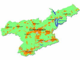
Location of Karlskamp in Gummersbach |
||
Karlskamp is a district of Gummersbach in the Oberbergischer Kreis in southern North Rhine-Westphalia , Germany .
geography
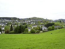
Karlskamp is located approx. 2.6 km from the city center between the immediately adjacent districts of Steinenbrück and Strombach . A third of the village is located north of the L 323 in a valley below the Hömerich (367 m above sea level), two thirds are south of the state road on the slope of the Höchst (344 m above sea level).
history
Until the 19th century there was only a single farm on site. Previously only on record as a corridor name ("Karls Kamp"), the district only existed as such since the second half of the 1930s and was first mentioned in an address book in 1940 . At that time there were four families on record.
From the late 1940s to the 1960s, an extensive new building area was built here with a few five-story multi-family houses (northern part) and numerous one and two-family houses (southern part), where a considerable number of displaced persons , mainly from Silesia and East Prussia , were mainly in the latter . were settled.
Until 1974 Karl Kamp was one like the other places of the old peasantry current Bach to community Gimborn , which at that time was dissolved as part of the municipality of reorganization.
traffic
The Karlskamp stop is connected by bus routes 316 (Gummersbach Bf - Neuremscheid ) and 361 (Gummersbach - Strombach - Gummeroth ).
Individual evidence
- ^ Landesvermessungsamt Nordrhein-Westfalen (ed.): Nordrhein-Westfalen. Official topographic maps ("Top50") . Federal Agency for Cartography and Geodesy, 2003, ISBN 3-89439-721-7 .
- ↑ to Mr Gerhard Pomykaj, city historian / archivist of the city Gummersbach


