Lope (Gummersbach)
|
Lope
City of Gummersbach
Coordinates: 51 ° 0 ′ 56 ″ N , 7 ° 31 ′ 30 ″ E
|
||
|---|---|---|
| Height : | 295 m above sea level NN | |
| Postal code : | 51643 | |
| Area code : | 02261 | |
|
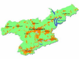
Location of Lope in Gummersbach |
||
Lope is a formerly independent district of Gummersbach in the Oberbergisches Kreis in southern North Rhine-Westphalia , Germany .
geography
The place is in the southwest of Gummersbach. The Loper Bach, which flows into the Agger, rises on the western edge of the village . Neighboring towns are Strombach , Hardt-Hanfgarten and Lobscheid .
history
In 1546 the place was first mentioned in a document with the place name "yn der Lope" in the Turkish tax list . The formerly independent district of Lope has belonged to the northern part of Strombach since the 1950s. The place name Lope is used consistently in all historical as well as in current topographic maps.
bus connections
Lope is connected to local public transport via the “Lope” and “Siebenbürger Siedlung” stops on line 316.
Individual evidence
- ↑ a b Topographical Information Management TIM-online, provided by the Cologne District Government
- ^ Klaus Pampus: First documentary naming of Oberbergischer places (= contributions to Oberbergischen history. Sonderbd. 1). Oberbergische Department 1924 eV of the Bergisches Geschichtsverein, Gummersbach 1998, ISBN 3-88265-206-3 .
- ↑ Historika25, State Surveying Office NRW, sheet 4911, Gummersbach
- ↑ Busnetz 2013, Oberbergischer Kreis, published by Verkehrsverbund Rhein-Sieg GmbH

