Niedergelpe
|
Niedergelpe
City of Gummersbach
Coordinates: 51 ° 2 ′ 3 ″ N , 7 ° 28 ′ 50 ″ E
|
||
|---|---|---|
| Height : | 220 (213–260) m above sea level NN | |
| Residents : | 301 (Jun. 30, 2016) | |
| Postal code : | 51647 | |
| Area code : | 02261 | |
|
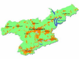
Location of Niedergelpe in Gummersbach |
||
|
Half-timbered house in Niedergelpe
|
||
Niedergelpe is a district of Gummersbach in the Oberbergisches Kreis in southern North Rhine-Westphalia .
geography
The small town spreads out on the southern slope of the Nordhelle (390 m above sea level) and along the Gelpe , a 5 km long left tributary of the Leppe . Niedergelpe is about 8.8 km from the city center on the L 306 ( Engelskirchen - Meinerzhagen ).
history
In 1174 the place (not yet differentiated between “Nieder-” and “Ober-” as Gelpe ) was first mentioned in a document in connection with the transfer of the tithe by the Severinsstift to Vogt Engelbert von Berg .
During the Reformation , Niedergelpe had withdrawn from the influence of the Marienheider monastery or the Catholic Schwarzenbergs and remained facing the Hülsenbusch chapel , in contrast to the neighboring farmers of Obergimborn, which remained Catholic.
Around 1610 there was a princely grain mill on the Gelepe (= Gelpe) farm .
Until the beginning of the 19th century Niedergelpe (formerly also called "Niedergimborn") was the main town of the homonymous peasantry , to which the towns of Kalkkuhl , Nochen , Peisel , Elbach , Flaberg , Hagen , Würden , Thal, Berghausen and Gimborn belonged and which until 1806 Was part of the imperial rule Gimborn-Neustadt . In 1819 the community of Gimborn was formed from the old farmers' communities Strombach , Obergelpe, Niedergelpe / Niedergimborn, Obergimborn and Remshagen .
The denominational boundary that emerged in the 16th century had an effect until the 20th century, when the Gimborn community was dissolved in 1974 and the Catholic villages of Obergimborn were incorporated into Marienheide, but the evangelical villages were assigned to the old Niedergelpe farmers' community in Gummersbach.
Association
- The sports club "TV Gelpetal" has existed since 1931.
traffic
The Niedergelpe bus stop is connected via bus routes 307 (Gummersbach Bf - Berghausen - Lindlar ) and 316 (Gummersbach Bf - Engelskirchen) and has been served every day at one hour intervals since the 2019/20 winter timetable.
Individual evidence
- ^ Landesvermessungsamt Nordrhein-Westfalen (ed.): Nordrhein-Westfalen. Official topographic maps ("Top50") . Federal Agency for Cartography and Geodesy, 2003, ISBN 3-89439-721-7 .
- ^ A b Klaus Pampus: First documentary naming of Oberbergischer places (= contributions to Oberbergischen history. Special volume 1). Oberbergische Department 1924 eV of the Bergisches Geschichtsverein, Gummersbach 1998, ISBN 3-88265-206-3 .
- ↑ a b c Jürgen Woelke: Alt-Gummersbach. In contemporary images and views. Volume 2: A foray through the city and its 70 villages. Gronenberg, Gummersbach 1980, ISBN 3-88265-024-9 .


