Mill (Gummersbach)
|
Mill
City of Gummersbach
Coordinates: 51 ° 0 ′ 26 ″ N , 7 ° 33 ′ 25 ″ E
|
||
|---|---|---|
| Height : | 199–225 m above sea level NN | |
| Residents : | 102 (Jun. 30, 2016) | |
| Postal code : | 51645 | |
| Area code : | 02261 | |
|
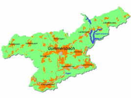
Location of Mühle in Gummersbach |
||
|
View of the mill from the east
|
||
Mühle is a district of the city of Gummersbach in the Oberbergisches Kreis in southern North Rhine-Westphalia .
geography
The place is about 3.4 km from the city center on the right bank of the Rospebach in direct connection to the western bypass road Gummersbach ( B 256 ; here "Westtangente"). Neighboring districts are Hardt-Hanfgarten (north-northwest), Rospe (north-northeast) and Luttersiefen on the opposite eastern side of the "West Tangent".
history
1542 the place was the first official mention as Roerich and other inhabitants op of moles in the peasantry Rospe in the Turkish tax lists were called.
From the beginning of the 19th century nothing was known of a mill, the existence of which is indicated by the place name.
Around 1750 the population was around 20, in 1850 around 40. The brandy distillery in Mühle at that time was only one of 63 in what was then the Gummersbach district.
The hamlet of Mühle belonged to the imperial rule of Gimborn-Neustadt until 1806 . After belonging to the Grand Duchy of Berg (1806-1813) and a provisional transitional administration , the region came to the Kingdom of Prussia in 1815 on the basis of the agreements made at the Congress of Vienna . Under the Prussian administration, the place first belonged to the Gimborn district (1816–1825) and then to the Gummersbach district in the Rhine Province . In 1843 the place had 46 inhabitants, all of whom were Protestants, and 11 houses.
traffic
The Mühle bus stop is connected to the 306 bus (Gummersbach Bf - Wiehl ).
Individual evidence
- ^ Klaus Pampus: First documentary naming of Oberbergischer places (= contributions to Oberbergischen history. Sonderbd. 1). Oberbergische Department 1924 eV of the Bergisches Geschichtsverein, Gummersbach 1998, ISBN 3-88265-206-3 .
- ↑ Johann Friedrich Franz von Steinen : Description of the parishes of Gummersbach, Lieberhausen, Gimborn and Müllenbach as well as the Marienheyde monastery. (1856). Viewed from the original text and published by the Förderverein Schloss Homburg eV Förderverein Schloss Homburg, Homburg 1983, ISBN 3-88265-107-5 .
- ^ Jürgen Woelke: Alt-Gummersbach. In contemporary images and views. Volume 2: A foray through the city and its 70 villages. Gronenberg, Gummersbach 1980, ISBN 3-88265-024-9 .
- ↑ a b Royal Government of Cöln (Ed.): Overview of the components and list of all localities and individually named properties of the government district of Cöln, according to districts, mayor's offices and parishes, with information on the number of people and the residential buildings, as well as the confession, Jurisdictions, military and former state relationships. Cologne 1845, p. 28 ( digitized version ).


