Sonnenberg (Gummersbach)
|
Sonnenberg
City of Gummersbach
Coordinates: 51 ° 2 ′ 35 ″ N , 7 ° 31 ′ 53 ″ E
|
||
|---|---|---|
| Height : | 340-350 m above sea level NN | |
| Residents : | 10 (Jun 30, 2016) | |
| Postal code : | 51647 | |
| Area code : | 02261 | |
|
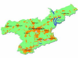
Location of Sonnenberg in Gummersbach |
||
Sonnenberg is a district of Gummersbach in the Oberbergischer Kreis in southern North Rhine-Westphalia .
Location and description
Sonnenberg is about 6.3 km from the city center of Gummersbach . Neighboring towns are Herreshagen , Windhagen , Wasserfuhr and Gummeroth . The Rospebach rises in the south of the village .
history
First mention
The place was mentioned for the first time in 1326, namely "Ludwig von Sonnenberg seals a certificate from the renters of Cologne " (localization uncertain because of places with the same name). Spelling of the first mention: Sonnenberg
The place Sonnenberg belonged to the imperial rule Gimborn-Neustadt until 1806 .
hike
The local circular hiking trail marked with the sign A3 leads through the village.
Individual evidence
- ↑ a b Topographical Information Management TIM-online, provided by the Cologne District Government
- ^ Jürgen Woelke: Alt-Gummersbach. In contemporary images and views. Volume 2: A foray through the city and its 70 villages. Gronenberg, Gummersbach 1980, ISBN 3-88265-024-9 .
- ↑ Royal Government of Cologne (Ed.): Overview of the components and list of all the localities and individually named properties of the government district of Cologne, according to districts, mayor houses and parishes, with information on the number of people and the residential buildings, as well as the confessions, jurisdictions , Military and earlier country conditions. Made on the basis of the officially requested messages. sn, Cologne 1845, p. 26 ( online edition at the Düsseldorf State Library ).

