Peisel
|
Peisel
City of Gummersbach
Coordinates: 51 ° 1 ′ 43 ″ N , 7 ° 28 ′ 5 ″ E
|
||
|---|---|---|
| Height : | 200 m above sea level NN | |
| Residents : | 59 (Jun 30, 2016) | |
| Postal code : | 51647 | |
| Area code : | 02261 | |
|
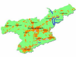
Location of Peisel in Gummersbach |
||
|
Peisel
|
||
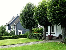
Peisel is a district of the town of Gummersbach in the Oberbergisches Kreis in southern North Rhine-Westphalia .
geography
Peisel is about 7.9 km from the city center of Gummersbach on the L 306 (from Meinerzhagen to Engelskirchen ) on the right bank of the Gelpe, an approximately 5.2 km long tributary of the Leppe . The district of Nochen borders on Peisel to the northeast; another neighboring district of Gummersbach is Elbach in the southwest.
history
According to Heinrich Dittmaier , the place name ( Peisel means something like "Puddle, damp spot") indicates a time of origin in the "youngest, post-medieval settlement layer".
The place was first mentioned in 1469 when a Thomas in the Peisel acted as a witness in a dispute between Berg and Mark .
Even before 1600 should the court Peisel some importance have had since the later so-called peasant Niedergelpe was named at that time by this court. In 1610, Peisel represents the first step towards the expansion of the Schwarzenberg property, the later county of Gimborn : Adam von Schwarzenberg claims in a letter to his liege, the Brandenburg Elector Johann Sigismund , the “Peyssel peasantry with their 24 cottages, haughty people and people sat in it ” and that “ the Peyssel court is unified and incorporated into the Gimborn court ” .
A good two hundred years later, the place is reported:
“A Junckherr formerly lived on this farm, who had his own jurisdiction, which also included a certain court justice over various goods nearby, over which a certain feud or lath was held at this farm (...) from a former castle or castle On which the Junckherr is said to have lived there, one can no longer find any trace. Under this courtyard and near it is a stately grain mill, which, however, is a long lease. It is driven by the Gelper Bach. "
The place Peisel belonged to the imperial rule Gimborn-Neustadt until 1806 . After belonging to the Grand Duchy of Berg (1806-1813) and a provisional transitional administration , the region came to the Kingdom of Prussia in 1815 on the basis of the agreements made at the Congress of Vienna . Under the Prussian administration, the place first belonged to the Gimborn district (1816–1825) and then to the Gummersbach district in the Rhine Province . In 1843 there were 5 houses in Peisel.
Around 1800 Peisel had 15 inhabitants, around 1900 the number of inhabitants had risen to 38.
School system
In 1885 it was decided to found a new school in Peisel to relieve the overcrowded schools in Hülsenbusch and Berghausen . Up to 100 children were taught in one class here, in two shifts until 1947 and finally in a second classroom from 1954. When the central school in Hülsenbusch-Wegescheid was finished in the 1970s , the Peiseler school was closed. For a few years now, the well-preserved school building, which was built using massive quarry stone, has housed the “Free Christian Primary School Peisel”.
traffic
The Peisel stop is connected by bus lines 307 (Gummersbach Bf - Berghausen - Lindlar ) (but here, Nochen stop, approx. 100 m away) and 316 (Gummersbach Bf - Neuremscheid ).
Individual evidence
- ^ Landesvermessungsamt Nordrhein-Westfalen (ed.): Nordrhein-Westfalen. Official topographic maps ("Top50") . Federal Agency for Cartography and Geodesy, 2003, ISBN 3-89439-721-7 .
- ^ Klaus Pampus: First documentary naming of Oberbergischer places (= contributions to Oberbergischen history. Sonderbd. 1). Oberbergische Department 1924 eV of the Bergisches Geschichtsverein, Gummersbach 1998, ISBN 3-88265-206-3 .
- ↑ a b c Jürgen Woelke: Alt-Gummersbach. In contemporary images and views. Volume 2: A foray through the city and its 70 villages. Gronenberg, Gummersbach 1980, ISBN 3-88265-024-9 .
- ↑ a b Royal Government of Cöln (Ed.): Overview of the components and list of all localities and individually named properties of the government district of Cöln, according to districts, mayor's offices and parishes, with information on the number of people and the residential buildings, as well as the confession, Jurisdictions, military and former state relationships. Cologne 1845, p. 27 ( digitized version ).


