Apple tree (Gummersbach)
|
Apple tree
City of Gummersbach
Coordinates: 51 ° 1 ′ 29 ″ N , 7 ° 29 ′ 8 ″ E
|
||
|---|---|---|
| Height : | 300 m above sea level NN | |
| Residents : | 28 (Dec. 31, 2019) | |
| Postal code : | 51647 | |
| Area code : | 02261 | |
|
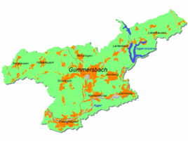
Location of Apfelbaum in Gummersbach |
||
Apfelbaum is a district of Gummersbach in the Oberbergischer Kreis in the administrative district of Cologne in North Rhine-Westphalia .
geography
Apple tree is located on the western city limits of Gummersbach. Immediately adjacent are Birnbaum and Rodt in the Gummersbach city area and Wallefeld in the Engelskirchen community . The apple tree extends on a ridge in the south of the Gelpe valley.
history
The place Apfelbaum belonged to the imperial rule Gimborn-Neustadt until 1806 .
traffic
The Apfelbaum stop is connected to the 317 bus (Gummersbach - Ründeroth ).
Individual evidence
- ↑ Royal Government of Cologne (Ed.): Overview of the components and list of all the localities and individually named properties of the government district of Cologne, according to districts, mayor houses and parishes, with information on the number of people and the residential buildings, as well as the confessions, jurisdictions , Military and earlier country conditions. Made on the basis of the officially requested messages. sn, Cologne 1845, p. 26 ( online edition at the State Library of Düsseldorf )

