Lobscheid
|
Lobscheid
City of Gummersbach
Coordinates: 51 ° 0 ′ 12 ″ N , 7 ° 31 ′ 34 ″ E
|
||
|---|---|---|
| Height : | 307 (270–353) m above sea level NN | |
| Residents : | 397 (June 30, 2016) | |
| Postal code : | 51645 | |
| Area code : | 02261 | |
|
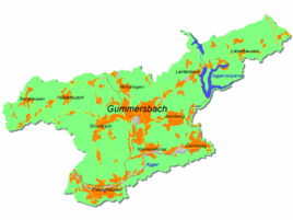
Location of Lobscheid in Gummersbach |
||
Lobscheid is a district of Gummersbach in the Oberbergisches Kreis in southern North Rhine-Westphalia .
geography
The place is about six kilometers from the city center on the L 321 running from the district Herreshagen in the north to Dieringhausen in the south. Neighboring Gummersbach districts are Strombach (-Lope) (north) and Dieringhausen (-Hohl) (south). Lobscheid is located along the Siepen of the Burbach, which rises here, between the peaks Eckkopf (375 m above sea level) in the north, Lobscheid (363 m above sea level) in the west and Hundskbochen (357 m above sea level) in the east and Burgberg (371 m above sea level) above sea level) in the southeast.
history
According to the settlement researcher Heinrich Dittmaier , the town was founded in the main clearing time around the year 1000. The place was first mentioned in 1363 when a Winant von Lovenschede was named as a landowner and councilor in Reval . A file in the Düsseldorf State Archives shows that Heydrich Hont von Lauffenscheit was Vogt of Bergneustadt .
The village of Lobscheid belonged to the imperial rule of Gimborn-Neustadt until 1806 .
In 1748 Lobscheid had almost 100 inhabitants, in 1798 the population was around 150; Around 1914 there were around 300 people living in the village and today well over 400.
The women and girls choir Lobscheid eV was founded in 1919 and is one of the oldest choir foundations in the district. In 2001 the choir merged with the Lobscheid men's choir to form the Lobscheid choir community.
Culture
School system
From 1903 to 1967 Lobscheid had its own school.
Association
- The Lobscheid eV choir community
- Volunteer firefighter; Löschgruppe Lobscheid (since January 1, 2014 merged with the Strombach unit to form the Strombach-Lobscheid unit)
- Friedhofs-Gemeinschaft eV Lobscheid, with its own cemetery chapel.
- Dorfgemeinschaft Lobscheid 2005 eV
hike
The SGV offers the A1 hiking trail (5.3 km) from the Lobscheid hiking car park .
traffic
The stops at Zum Niederfeld, Lobscheid Mitte and Zum Burgberg are served by bus line 316 (Gummersbach - Dieringhausen).
Web links
Individual evidence
- ^ Landesvermessungsamt Nordrhein-Westfalen (ed.): Nordrhein-Westfalen. Official topographic maps ("Top50") . Federal Agency for Cartography and Geodesy, 2003, ISBN 3-89439-721-7 .
- ^ Klaus Pampus: First documentary naming of Oberbergischer places (= contributions to Oberbergischen history. Sonderbd. 1). Oberbergische Department 1924 eV of the Bergisches Geschichtsverein, Gummersbach 1998, ISBN 3-88265-206-3 .
- ↑ a b Jürgen Woelke: Alt-Gummersbach. In contemporary images and views. Volume 2: A foray through the city and its 70 villages. Gronenberg, Gummersbach 1980, ISBN 3-88265-024-9 .
- ↑ Royal Government of Cologne (Ed.): Overview of the components and list of all the localities and individually named properties of the government district of Cologne, according to districts, mayor houses and parishes, with information on the number of people and the residential buildings, as well as the confessions, jurisdictions , Military and earlier country conditions. Made on the basis of the officially requested messages. sn, Cologne 1845, p. 26 ( online edition at the Düsseldorf State Library ).

