Hereditary Land (Gummersbach)
|
Hereditary land
City of Gummersbach
Coordinates: 50 ° 59 ′ 11 ″ N , 7 ° 30 ′ 23 ″ E
|
||
|---|---|---|
| Height : | 191 m above sea level NN | |
| Residents : | 268 (Dec. 31, 2019) | |
| Postal code : | 51645 | |
| Area code : | 02261 | |
|
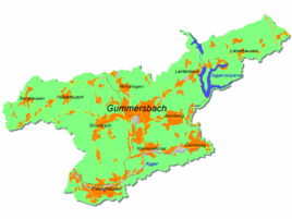
Location of Erbland in Gummersbach |
||
Erbland is a district of Gummersbach in the Oberbergischer Kreis in southern North Rhine-Westphalia , Germany .
geography
The place is located west of Dieringhausen in the Aggertal on the left bank of the river. Erbland has a connection to the federal highway 55 , which does not affect the place directly. The city center is around 9.5 km away.
history
In 1575 the place was first mentioned as Erffland on the "Map of the Bergisch Office Windeck and the Lordship of Homburg " by Arnold Mercator .
Associations and institutions
- Dorf- und Sportgemeinschaft Erbland eV
traffic
The place is only indirectly connected to public transport . It can be reached by bus line 310 (Gummersbach - Overath ) via the Brunohl stop , from there about 1 km on foot.
Individual evidence
- ^ Klaus Pampus: First documentary naming of Oberbergischer places (= contributions to Oberbergischen history. Sonderbd. 1). Oberbergische Department 1924 eV of the Bergisches Geschichtsverein, Gummersbach 1998, ISBN 3-88265-206-3 .


