Dümmlinghausen
|
Dümmlinghausen
City of Gummersbach
Coordinates: 51 ° 1 ′ 37 ″ N , 7 ° 36 ′ 56 ″ E
|
||
|---|---|---|
| Height : | 225 m above sea level NN | |
| Residents : | 1062 (Dec. 31, 2019) | |
| Postal code : | 51645 | |
| Area code : | 02261 | |
|
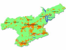
Location of Dümmlinghausen in Gummersbach |
||
Dümmlinghausen is a district of Gummersbach in the Oberbergischer Kreis in southern North Rhine-Westphalia , Germany .
geography
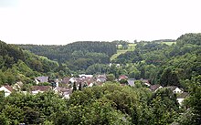
The street village lies in a narrow valley of the Agger and extends at its northeast end to below the barrier wall of the Aggertalsperre . His local mountain is the Aehlenberg . Depending on the route, about four or five kilometers from the city center, Dümmlinghausen extends largely along the L 337. The eastern border of the town also forms the border to the neighboring town of Bergneustadt , from whose center Dümmlinghausen is also a good four kilometers away.
history
In 1465 the place was first mentioned in a document; According to Klaus Pampus, "Gabriel de Bodenbach (= Bomig ) immigrated to Homburg from Dumelkusen in the Brandenburg region that year ".
Settlement names on -inghausen are usually a combination of the basic word -hausen (for settlement) and a personal name (here Duomilo) with the suffix -ing, which denotes the affiliation of the settlers to this person. In the northern part of the Oberbergisches there are about 40 places that are formed according to this pattern.
Culture
Church institutions
- Ev. Parish hall Dümmlinghausen
- Ev. Derschlag-Rebbelroth-Dümmlinghausen parish
Hiking and bike paths
The following hiking trail is offered by the Sauerland Mountain Association from the Dümmlinghausen hiking car park :
- A1 (4.5 km)
particularities
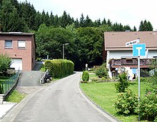
No joke one can say, “Dümmlinghausen is on the North Pole”, because a 1.5 km long stretch of the village street bears this curious name. At the north end of the street Am Nordpol is house no.1, at the south end house no.16.
Transport (bus and train)
The stops at Dümmlinghausen Brücke, An der Nordhelle, Auf dem Kamp and Leimicke Abzw. Are connected via the bus line 303 (Gummersbach - Eckenhagen / Waldbröl ). The Nordhelle and Kamp stops are only served intermittently, mainly during school hours, then the bus drives an additional loop from the roundabout to almost the Aggertalsperre and back again. Usually the bus turns right at the roundabout in Dümmlinghausen in the direction of Bernberg.
Until the 1950s, there were two train stations of the Gummersbacher Kleinbahnen in Dümmlinghausen , a standard-gauge, electrified railway line that was operated as a tram for passenger traffic; it led via Derschlag to Gummersbach.
Individual evidence
- ^ Klaus Pampus: First documentary naming of Oberbergischer places (= contributions to Oberbergischen history. Sonderbd. 1). Oberbergische Department 1924 eV of the Bergisches Geschichtsverein, Gummersbach 1998, ISBN 3-88265-206-3 .
- ^ Heinrich Dittmaier : settlement names and settlement history of the Bergisches Land (= journal of the Bergisches Geschichtsverein . Vol. 74). Schmidt, Neustadt an der Aisch 1956.
- ^ Michael Gockel: Settlement Name Types I and II. Commentary on Map 28a-b of the Historical Atlas of Hesse. In: Fred Schwind (Ed.): Historical Atlas of Hessen. Text and explanatory volume. State Office for Historical Regional Studies, Marburg / Lahn 1984, pp. 185–189.
- ↑ The story of Dümmlinghausen on the Dieringhausen.de website


