Lützinghausen
|
Lützinghausen
City of Gummersbach
Coordinates: 51 ° 1 ′ 44 ″ N , 7 ° 30 ′ 3 ″ E
|
||
|---|---|---|
| Height : | 333 (313-340) m above sea level NN | |
| Residents : | 125 (Jun 30, 2016) | |
| Postal code : | 51647 | |
| Area code : | 02261 | |
|
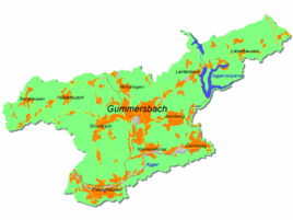
Location of Lützinghausen in Gummersbach |
||
|
Lützinghausen from the south. Right: mansion
|
||
Lützinghausen is a district of the city of Gummersbach in the Oberbergisches Kreis in southern North Rhine-Westphalia .
geography
The place is about 5.2 km from the city center on the L 323, which only affects it. Neighboring Gummersbacher districts are Hülsenbusch in the north, Waldesruh in the east and Birnbaum , Apfelbaum and Rodt in the west and southwest.
history
1287 the place was first mentioned in the documentary, as Count Johann von Sayn jurisdiction Lucinchusen to Count Eberhard II, Count of the Mark pledged. In 1335, in a later document from Count Adolf II von der Mark , Lüdzinchusen is still called Vest .
In the 16th century, the free manor Lützinghausen was owned by the von Moellenbeck (= Müllenbach ), who at that time also provided the Vogt of Neustadt . By marriage, the knight's seat came to the very wealthy von Omphal family, who came from the Bergisch region . In 1763, Lützinghausen's time as a manor was over - the property fell into the hands of the wealthy bourgeoisie.
The village of Lützinghausen belonged to the imperial rule of Gimborn-Neustadt until 1806 . After belonging to the Grand Duchy of Berg (1806-1813) and a provisional transitional administration , the region came to the Kingdom of Prussia in 1815 on the basis of the agreements made at the Congress of Vienna . Under the Prussian administration, the place first belonged to the Gimborn district (1816–1825) and then to the Gummersbach district in the Rhine Province .
In 1781 the population of the place was 85, in 1831 there were 130, and in 1910 Lützinghausen had 100 inhabitants.
Mining
“You can find a lot of ironstone and lead ore in this area. A lead mine, called Cäcilie, has been here since 1805, which is operated by several interested parties on the road that goes from the Strombach to Lützekusen, which brings very good lead ore to light. "
Contrary to Steinens' note , mining in Lützinghausen was founded much older; In 1805 only the mining rights changed and a new tunnel was dug. 1833, the yield of was lead ore and aperture very satisfactory; In 1850 an attempt was made to deepen the previous opencast mine by eight meters, but the problem of water penetration was unsolvable for the technology at the time. In 1859 Cäcilia was liquidated by the "Kölnische Bergwerksgesellschaft", but for the period from 1870 to 1874 reactivated for the last time by the "Rheinische Konsolidierte Bergwerksgesellschaft". Between 1826 and 1874, 2155 tons of zinc and 329 tons of lead ore were extracted from the approximately two meter thick ore, making the Cäcilia mine one of the most productive in the region.
Culture
Attractions
In 1733 Theodor Kaspar von Omphal and his wife Anna von Moellenbeck built a mansion, the Lützinghausen house . On the imposing two-storey quarry stone building with a two-story mansard roof , the fluted corner pilasters , the “Omphal-Neuhoff” alliance coat of arms and two weather vanes with the same coat of arms and the year 1733 on the roof are particularly worth seeing. The "castle" is inhabited and can only be viewed from the outside.
hike
The historic hiking trail X13 Breckerfeld - Schladern , 57.5 km long , leads through Lützinghausen .
traffic
The bus stop in Lützinghausen is connected via bus lines 316 (Gummersbach– Hagen -) Strombach (- Dieringhausen ) and 317 (Gummersbach– Ründeroth ).
Individual evidence
- ^ Landesvermessungsamt Nordrhein-Westfalen (ed.): Nordrhein-Westfalen. Official topographic maps ("Top50") . Federal Agency for Cartography and Geodesy, 2003, ISBN 3-89439-721-7 .
- ^ Klaus Pampus: First documentary naming of Oberbergischer places (= contributions to Oberbergischen history. Sonderbd. 1). Oberbergische Department 1924 eV of the Bergisches Geschichtsverein, Gummersbach 1998, ISBN 3-88265-206-3 .
- ↑ a b c Jürgen Woelke: Alt-Gummersbach. In contemporary images and views. Volume 2: A foray through the city and its 70 villages. Gronenberg, Gummersbach 1980, ISBN 3-88265-024-9 .
- ↑ Royal Government of Cologne (Ed.): Overview of the components and list of all the localities and individually named properties of the government district of Cologne, according to districts, mayor houses and parishes, with information on the number of people and the residential buildings, as well as the confessions, jurisdictions , Military and earlier country conditions. Made on the basis of the officially requested messages. sn, Cologne 1845, p. 26 ( online edition at the Düsseldorf State Library ).


