Herreshagen
|
Herreshagen
City of Gummersbach
Coordinates: 51 ° 2 ′ 50 ″ N , 7 ° 31 ′ 22 ″ E
|
||
|---|---|---|
| Height : | 351 (340-370) m above sea level NN | |
| Residents : | 382 (Jun 30, 30) | |
| Postal code : | 51647 | |
| Area code : | 02261 | |
|
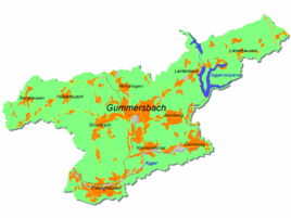
Location of Herreshagen in Gummersbach |
||
Herreshagen is a district of Gummersbach in the Oberbergisches Kreis in southern North Rhine-Westphalia .
geography
Herreshagen is about 5.9 km from the city center of Gummersbach in a valley between the northern elevations of Stentenberg and Warenkopf and the southern hills of Gummershardt and Sonnenberg.
history
1535 the place was first recorded mention by Huppert van Hersthagen in Freibedeliste the free count was performed Adolf Möllenbeck.
The village of Herreshagen belonged to the imperial rule of Gimborn-Neustadt until 1806 .
leisure
Association
- Herreshagen village association
Hiking and bike paths
- SGV offers the A4 hiking trail from the Herreshagen hiking car park .
traffic
The Herreshagen and Herreshagen Siedlung stops are connected by bus line 307 (Gummersbach Bf - Lindlar ).
Individual evidence
- ^ Klaus Pampus: First documentary naming of Oberbergischer places (= contributions to Oberbergischen history. Sonderbd. 1). Oberbergische Department 1924 eV of the Bergisches Geschichtsverein, Gummersbach 1998, ISBN 3-88265-206-3 .
- ↑ Royal Government of Cologne (Ed.): Overview of the components and list of all the localities and individually named properties of the government district of Cologne, according to districts, mayor houses and parishes, with information on the number of people and the residential buildings, as well as the confessions, jurisdictions , Military and earlier country conditions. Made on the basis of the officially requested messages. sn, Cologne 1845, p. 26 ( online edition at the Düsseldorf State Library ).

