Gummeroth
|
Gummeroth
City of Gummersbach
Coordinates: 51 ° 2 ′ 12 ″ N , 7 ° 31 ′ 38 ″ E
|
||
|---|---|---|
| Height : | 326 (317-342) m above sea level NN | |
| Residents : | 380 (Dec. 31, 2019) | |
| Postal code : | 51647 | |
| Area code : | 02261 | |
|
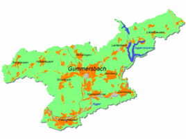
Location of Gummeroth in Gummersbach |
||
Gummeroth is a district of Gummersbach in the Oberbergisches Kreis in southern North Rhine-Westphalia .
geography
Gummeroth is located approx. 4.7 km from the city center of Gummersbach between the elevations Gummershardt, Hömerich and Stahlberg. This is where the Strombach rises , which flows into the Agger in Vollmerhausen .
history
The place was first mentioned in documents in 1450, when "Pueri Teilonis (German: descendants of the parts) and other residents to (= to) Gummeroide " were listed as wax interest from the Cologne Apostle monastery .
The village of Gummeroth belonged to the imperial rule of Gimborn-Neustadt until 1806 .
The name Gummeroth is reminiscent of Gummersbach (both place names possibly go back to a proper name Gummar or Gumbir ).
leisure
Association
- The fire fighting group of the Gummeroth volunteer fire brigade belongs to the Gummersbach volunteer fire brigade . The village festival organized by the Gummerother fire brigade takes place every year on the first weekend in July.
Other associations in Gummeroth:
- Crochet Association Gummeroth
- Women's Association Gummeroth
Excursion destinations
- In the farm café "In the old house" you can get home-baked cakes and Bergisch waffles as well as hiking maps for excursions in the area.
Hiking and bike paths
- The "Geology and History in Bergisch Gladbach" hiking trail leads through Gummeroth:
- Main hiking trail 11a Rheinischer Weg (approx. 59 km)
- Route: Bergisch Gladbach 0.0 - Herkenrath 7.0 - Brombach 17.0 - Hohkeppel 22.0 - Holz 27.0 - Berghausen 42.0 - Gummeroth 50.0 - Gummersbach-Niederseßmar 59.0
- There are a number of circular routes around and over the nearby Gummershardt and Hömerich elevations . On the Gummershardt there used to be a listed 15 m high observation tower , which had been closed since 2006 and was finally blown up in 2011 due to its disrepair.
traffic
The stops Gummeroth Mitte and G. Dorfplatz are connected by bus routes 307 (Gummersbach train station - Lindlar - Gimborn ) and 361 (Gummersbach train station - Gummeroth Dorfplatz).
Individual evidence
- ^ Klaus Pampus: First documentary naming of Oberbergischer places (= contributions to Oberbergischen history. Sonderbd. 1). Oberbergische Department 1924 eV of the Bergisches Geschichtsverein, Gummersbach 1998, ISBN 3-88265-206-3 .
- ↑ Royal Government of Cologne (Ed.): Overview of the components and list of all the localities and individually named properties of the government district of Cologne, according to districts, mayor houses and parishes, with information on the number of people and the residential buildings, as well as the confessions, jurisdictions , Military and earlier country conditions. Made on the basis of the officially requested messages. sn, Cologne 1845, p. 26 ( online edition at the State Library of Düsseldorf )
- ↑ Holiday journal 2007/08 of the city of Gummersbach, page 4 ( Memento of the original dated December 3, 2008 in the Internet Archive ) Info: The archive link was inserted automatically and has not yet been checked. Please check the original and archive link according to the instructions and then remove this notice. (PDF; 3.53 MB)
- ↑ Lookout tower: No money to renovate on rundschau-online.de from December 18, 2010, accessed on December 5, 2015

