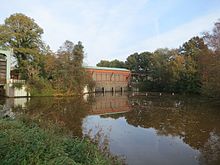
Kuhgraben (Bremen)
The Kuhgraben is a 3.2 km long straight canal running across the Wümme in the Bremen part of the Wümmeniederung. It was created as a drainage ditch and transport route in the course of the agricultural development ( elder colonization ) of the Wümmeniederung. Up until the middle of the 19th century, it stretched from the confluence with the Wümme twice as far to the south as it does today.
Historical framework
The often rumored statement that the name actually refers to its meaning as a borderline, for example as a corruption of Gaugraben , cannot be substantiated. The first written mention as a kograve comes from the year 1277, when the Archbishop of Bremen Giselbert received land on its banks from the Lilienthal monastery , which was founded in 1232 by his predecessor Gerhard II . The canal came under the direction of the Free City of Bremen in 1365. While the areas north of the Kleine Wümme had been under the control of the city of Bremen from 1500 onwards, the southern part formed the border to the Archbishopric or Duchy of Bremen until 1803 .
Course and history
Nowadays the Kuhgraben only connects the Wümme in the north, to which it has a connection through the Kuhsiel, with the Kleine Wümme , which it meets at the eastern end of the Wetterungsweg , at the eastern corner of the city forest . In pre-industrial times it continued along today's Parkallee towards the city center, where it was connected to the Dobben to the south of today's railway underpass , which in turn was connected to the Weser at the southern end of the Sielwall by a sluice . The current went from the Weser to the Wümme. Dobben and cow gifts together were part of the Bremen Landwehr . The transition to Schwachhausen was the (s. O.) To 1803 abroad secured the 1410 built Page Thorn , later by a rectangle continuously replaced. It stood north of the street called An der Weide today . In 1459 a grinding mill went into operation next to it , which was later converted into a fulling mill. On the north side of the street An der Weide and in the course of today's Breitenweg , the Kuhgraben continued as the southern boundary of the Bürgerweide up to the Weidedamm, which before the establishment of the Findorff district also included today's Findorffstraße . In contrast to the rest of the Kuhgraben, this stretch of water was a bit meandering and, historically, is to be regarded as a continuation of the Dobben. This south side of the Bürgerweide had marked a body of water called Widel in the Bremer Weidebrief . One of Bremen's peat harbors was located near the link between Kuhgraben and Dobben .
In 2007, a landing stage for tourist boat trips was set up at today's southern end of the Kuhgraben.
Kuhsiel
As maps of the Bremen land survey from the years 1798–1806 show, the Kuhsiel was already one of the large sluices that could be passed with small boats when the water level in the Wümme was low and the gate was open. If the sluice was closed when the water level of the Wümme was high, the boatmen had to pull their boats over the dike or have horses pulled over the dike to get out of the Wümme into the cow ditch, or vice versa. As a result of the of Jürgen Christian Findorff placed on the way Moor colonization the Torfschifffahrt increased, a lock was built. 1865 In 1931 it was replaced by a new lock. This was closed in 1993 due to malfunctions, but then fundamentally repaired and modernized in 1995. Since then it can be operated by the crews of passing boats themselves.
The pumping station at Kuhsiel was completed in 1965. It functions as a relief pumping station, so it is only used when the amount of water to be discharged exceeds the capacity of the Wasserhorst pumping station . There is no longer an actual sewer for passive drainage on the Kuhsiel. Instead, there is a supply pipe that enables water to flow from the Wümme into the Bremer Deichring in order to improve the water quality of the small Wümme and to maintain the wetland character of Hollerland and Blockland in times of low rainfall . While the Kuhgraben is more of a tributary of the Kleine Wümme according to today's water management, the current GKZ 49472 classifies it as a direct tributary of the Wümme.
Holler Fleet
The Holler Fleet, which formerly flowed through the Holler Siel in the Kreuzdeich north next to the Kuhgraben into the Wümme, now crosses under the Lehester Deich shortly before the Kreuzdeich and flows into the Kuhgraben. This means that the water from the Holler Fleet, unless the Kuhsiel pumping station is in use, passes through the Kuhgraben into the Kleine Wümme and finally through the machine fleet and the Wasserhorst pumping station into the Lesum.
See also
literature
- Bremen and its districts . Edition Temmen, 1st edition (2003), ISBN 3-86108-685-9 , ISBN 978-3-86108-685-7 .
Individual evidence
- ↑ Bremer Urkundenbuch I, p. 411/412, Certificate No. 375
- ↑ home club Liilienthal: The story Lilienthal
- ↑ Chronicle Horn-Lehe: Kuhgrabenweg
- ^ Schriften der Wittheit zu Bremen, Series A: Bremisches Jahrbuch, 42nd Volume 1947: The Pagenthorner Bauernschaft
- ↑ Bremen land survey by Christian Abraham Heineken :
- ^ Wümme sailing club: The lock in Kuhsiel ( Memento of the original from June 5, 2016 in the Internet Archive ) Info: The archive link was automatically inserted and not yet checked. Please check the original and archive link according to the instructions and then remove this notice.
Web links
- http://www.geoviewer.umwelt.bremen.de/
- Dyke association on the right bank of the Weser: water level from human hands (PDF)
Coordinates: 53 ° 7 ′ 3 ″ N , 8 ° 50 ′ 47 ″ E


