
Dobben (Bremen)
The Dobben was until 1864 a body of water of 1.3 km in length half a kilometer to the east of Bremen 's Old Town . Its former course can still be seen today on the streets Sielwall and Am Dobben . This is where the border between the districts of Mitte (Ostertor district) and Ostliche Vorstadt (Steintor district) runs.
Today Dobben in Bremen colloquially refers to a street crossing in the middle of the street Am Dobben , at which the short street Dobbenweg joins, as well as the local tram stop Am Dobben (formerly Dobbenweg ).
The Dobben waters


The water will have originated from an old tributary of the Weser, the water of which flowed to the Kleine Wümme . Whether the Weser water always entered this arm or only at high tide or only during special floods is not specified in the relevant works and can no longer be determined.
Before the Kuhgraben , first mentioned in 1277, was dug , the outflow to the small Wümme will have run south and west of the cattle pasture ; due to the slight slope, branching and more frequent relocation is likely. The aqua Widel mentioned in the letter to the pasture may have been part of this drainage route.
On the occasion of a military dispute between Archbishop Gottfried and the opposing candidate Maurizius, the Rynesberch Chronicle mentions a landwere by deme spittale ( Rembertispital ) in 1349 , which is regarded as the first reference to the Landwehr function of the Dobben. The inflow from the Weser into the ditch was now regulated by a sewer . The western bank facing the city was secured by a palisade fence or a small wall.
Ten years later the road from Ostertor to Hastedt was first referred to as steenstrate . Since the 17th century at the latest, the passage or transition of the Steinstraße has been called the Stone Gate , consisting of a drawbridge, a free-standing archway and the stone tower . Its year of construction is given in several sources as 1310, but this is due to a confusion with the gate between the actual old town and the Stephaniviertel, which was later walled off, which was referred to in 1284 as the porta lapidea , also known as the “stone gate”. The next time a porta lapidea is mentioned in a document from 1352, it remains to be seen whether the gate from the 13th century is still meant, or the Dobben crossing.
Then in 1410 the Pagenthorn (High German: horse tower ) was built at the connection of the Dobbens to the Kuhgraben , but was later replaced by a rectangular fort. Here the path from Herdentor to Schwachhausen crossed the water. At this point, a third body of water was connected, which, partly meandering, marked the southern edge of the Bürgerweide and was attributed by name to the cowshed in the first maps, but could be part of the original runoff. In 1459 a grinding mill was built at the end of the Dobben , which kept its name when it was later converted into a fulling mill . Long before the introduction of steam engines, however, the operation was completely stopped because the use of the Dobben as a mill canal caused floods again and again in the already precarious drainage situation of the blockland at the time .
Politically, the area formed a unit on both sides of this Landwehr, last called the Pagenthorn peasantry. One of their tasks in the city republic of Bremen, which was still strongly feudal until 1848, was the maintenance of the Dobben. When the gate was closed and the residents of the suburbs were treated as equal to those of the old town, the development of the eastern suburbs as a residential area began on a large scale . In connection with this, the Dobben was filled in in 1864 and the streets built in its place were among the best residential areas in Bremen for several years.
The street on the Dobben

The main street Am Dobben , which partly marks the course of the overbuilt body of water, is a busy street between the western street An der Weide , which comes from the main station in Bremen and the south / eastern street Sielwall, in the so-called quarter , i.e. in the districts of Ostertor and stone gate .
The tram has been running through this street since 1881, initially the ring line of the Great Bremen Horse Railway (electrified in 1910, discontinued in 1942), since 1919 line 10 of the Bremen tram , initially from Bismarckstraße north of the clinic via Vor dem Steintor and Hauptbahnhof to Walle , today from Sebaldsbrück via the main station to Gröpelingen .
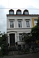
The street is accompanied by two to three-story residential and commercial buildings, mostly from the last third of the 19th century. The only free-standing buildings are the Villa Rutenberg and the Wichernhaus . Everything else is closed development . This development is on both sides between the Sielwall crossroads and the Dobbenweg. From Dobbenweg to Rembertistraße, only the south side is oriented towards the Dobben in terms of urban development, the northern side of the street has always consisted largely of the back of the southern properties of the street, except for the Schleifmühle .
Despite being close to the city center and having a main street function, more than half of the properties have kept their front gardens.

Am Dobben 88
Am Dobben 89

Am Dobben 91 ( Villa Rutenberg )

On the Dobben

Am Dobben 23: mural


The street Dobbenweg


When the "Dobben" body of water still existed, the Dobbenweg existed as a short path in a straight extension of today's Schwachhauser Heerstraße . It ended at Dobben, there was no bridge here. The route from Schwachhausen led over today's street "Besides the Schleifmühle" to Rembertistraße, where there was a bridge over the Dobben. When the Dobben was filled in in 1864 and replaced by the "Am Dobben" road, the Dobbenweg became the connecting road from Schwachhausen to the new road. On a map from 1865 it is still unnamed, on one from 1885 it is already called "Dobbenweg". For over 100 years it ended at the "Am Dobben" junction, where a tram junction was created.
In the late 1960s, a car-oriented traffic policy resulted in the demolition of large parts of the northern Ostertor and the construction of the Rembertikreisel. Eduard-Grunow-Straße, named in 1967, was laid out as a straight extension of Dobbenweg. Dobbenweg became one of the widest one-way streets in Bremen, and the block to the east of it became a large traffic island, which cars circumnavigated on the streets other than Schleifmühle - Schleifmühlenweg - Am Dobben - Dobbenweg. Only the tram runs in both directions over the Dobbenweg.
On the aerial photo on the right, you can clearly see the circular traffic routing and the tram route on both sides. The intersection in the center of the picture was expanded in the late 1950s, and the centaur fountain that had been there since 1891 was moved to the new town. On the comparison picture from 1899, Dobbenweg can be seen in the background, still a narrow street. The house in the center of the picture is on a piece of land that now belongs to the street. The widening must have taken place in the 1920s because the new corner building, the Centauren pharmacy , was built in 1928. In the front part of the building lines of the Schwachhauser Heerstraße are unchanged, the widening of the street gave way to the front gardens.
swell
- Dietrich Schomburg: Historical directory of the state of Bremen , Hildesheim 1964
- Hans Dörries (ed.): Bremen land survey 1790–98 (Bremen State Archives),
- Plate 1: CA Heineken: Map of the area of the Reich and Hanseatic City of Bremen, 1798
- Plate 6: Ing.Cap. Schilling 1772 (measurement) / printed 1795: Bremen with the suburbs
- On the Dobben . In: Association for Inner Mission in Bremen (ed.): The magazine of the street . The Bremen street magazine . Issue 66, March 2019, ISSN 2192-7324 .
Individual evidence
- ↑ BUB, Vol 3, No. 141 (page 120 /.. 121 ) : plateam dictam Stenstrate ; “Platea” was the common name for cobbled streets at the time
- ↑ Karolin Bubke: The Bremen city wall. Written tradition and archaeological findings from a medieval fortification structure. State Archive Bremen, Bremen 2007, ISBN 978-3-925729-48-5 (publications from the State Archive of the Free Hanseatic City of Bremen, vol. 68).
- ↑ BUB Vol. 3, No. 29 (pp. 22/23) of 1352
- ↑ Writings of Wittheit zu Bremen, series A: Bremisches Jahrbuch, 42nd volume 1947: The Pagenthorner farmers