
Walle (Bremen)

Telecommunication tower Bremen in Walle
South view from Waller Heerstraße In the yellow circle of Bremen Cathedral |
|
||||||||||||||||||||||||||||||||||||||||||
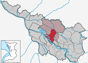

Walle is a district of Bremen and belongs to the Bremen city district West.
Geography and districts
Walle is located on the right bank of the Weser, west of the city center of Bremen. The neighboring districts are Gröpelingen in the north-west , Blockland in the north, Findorff in the north-east , Mitte in the east , ports in the south-west and Woltmershausen in the south across the Weser .
Utbremen
location and size
The district Utbremen bounded east by the B75 / 6 , northeast through the railway installations, northwest through the Hansestraße and south by the Hans-Böckler-Straße . To the east is the Mitte district with the Stephaniviertel, to the north is the Findorff district , to the northwest the Waller districts Westend and Steffensweg and south of the Waller district Überseestadt.
Area: 0.56 km², 3,255 inhabitants
timeline
"Ut-Bremen" - outside of Bremen - was the name of the old Utbremer Feldmark , which was directly in front of the Bremen city wall , in front of the western gates, the Stephanitor and the Doventor. Utbremen was first mentioned in 1072. The Stephanitorsteinweg and the Doventorstraße are the memories of these connections between the Utbremen district and Bremen. The Utbremer Straße led over the old Panzenberg to the village of Walle.
In 1848 the Feldmark Utbremen was incorporated. Utbremen - at that time also known as Doventorvorstadt - developed. The then established railway lines Weserbahn (1855) to Weserbahnhof (1857/59) and to Geestemünde (1862) strengthened the settlements in Utbremen. Hansestrasse and Haferkamp were built, with many other streets in between with their development from the so-called Wilhelminian era after 1870/71. There were still farms in between and a mill on Haferkamp, which was in operation until 1914 and whose hull was still standing in the 1930s. In 1875 a primary school was built on Nordstrasse, which was permanently destroyed in 1944. In 1878, the neo-Gothic Protestant Wilhadikirche on Nordstrasse, destroyed in 1944, was inaugurated as a branch church of the Stephanikirchgemeinde. Only a memorial stone reminds of the location.
When Bremen joined the German Customs Union in 1888 , the free ports developed as an external customs area , and Utbremen was intensively expanded. Up until the 1920s, a structurally closed area was created, consisting of two to four-story residential and commercial buildings. In 1928 the Volkshaus on Nordstrasse was built by the trade unions . In 1933 a 90 meter high wooden transmission tower was built, which was later destroyed by lightning and replaced by a steel tower.
On 18./19. August 1944, Utbremen was almost completely destroyed by an air raid during World War II.
After the war, the housing shortage in Utbremen was very great. The population lived in emergency shelters or in the neighboring parcel areas, in the so-called "quay houses", named after Mayor Wilhelm Kaisen , who granted the bombed out the right to live in the allotment garden areas. Reconstruction began in the early 1950s through several housing associations, u. a. by GEWOBA , which had already built here in the 1920s. The apartment blocks - relatively simple from a modern point of view, but bright and green - alleviated the acute housing shortage.
Streets
The street names refer to
- Professions and trades such as Kohlenstraße, Kötnerweg, Schifferstraße
- Family names such as Ellmerstraße, Kastningweg, Struckmannstraße
- Field names such as Auf dem Kamp, Haferkamp, Kielweg (parcel like a ship's keel)
- Geography such as Kumpweg (on the former Kumpgraben of the Bremen city wall ), Landwehrstraße (formerly part of the Bremen city fortifications), Utbremer Straße
- History like Hansestrasse through the Hanseatic League
- Country estates like Sternenhof
- North Sea islands such as Borkum , Juist and Norderneystrasse
- People like Bürgermeister- Deichmann- Strasse, Bürgermeister- Hildebrandt - Strasse , Friedrich-Naumann -Ring, Hans-Böckler- Strasse, Hegemannstrasse (captain and researcher), Koldeweystrasse (captain and researcher), Lindemanstrasse (research writer), Nansenstrasse , Otto -Finsch -Straße (researcher), Sengstackeplatz (captain and researcher), Wolfardstraße (editor)
Steffensweg
location and size
The Steffensweg district - predominantly a densely built-up residential area - is bounded to the east by the Waller Grün green corridor and the Westend district, to the north by Bremerhavener- and Bremervörder Strasse and the Walle district, to the west by Nordstrasse (Hafenrandstrasse), the Überseetor and the Überseestadt district south through Hansator / Hansestraße and the district of Utbremen. In the area between Schulze-Delitzsch-Straße, Steffensweg, Hansestraße and Nordstraße there is a small industrial area with mostly small craft businesses and a supermarket.
Area: 0.38 km², 4,360 inhabitants
Waller Wied

The district called Waller Wied or Heimatviertel is to be regarded as geographically independent within the Steffensweg district. This quarter with a triangular base is separated from the rest of the Walle district by a main road, Nordstrasse, bordered to the west by the port railway and opens to the south to the industrial area of the ports . “Wedged between the north road and the harbor fence” it is now surrounded by noise barriers.
With the opening of the free port in 1888 and the construction of the port operations and the jute factory, this district developed very rapidly. The Bremen architect Eduard Gildemeister designed the first houses for this quarter right next to the jute in 1889 . The migrant working-class families - many from the east - settled in the new workers' houses. The district was destroyed in a bomb attack in 1944. Although the city planners wanted the area west of Nordstrasse to be exclusively a port area, the residents succeeded in building houses there again from 1950 with the approval of the building authorities.
timeline
Before Walle became an independent parish, it was part of the St. Stephani church. The Kirchstraße was therefore the Steffensweg and the district was later given the same name. See the History section for more information .
Streets
The street names refer to
- Professions and trades such as Osterlingerstraße (Easterling = English merchants)
- Geography like Thüringer Straße,
- History like Hansestrasse , Steffensweg (St. Stephani parish)
- Local significance such as Am Syndikushof (formerly the estate of Syndikus Franz Köhne ), Eintrachtstraße, Friedensstraße, Heimatstraße and Grenzstraße (border to Waller Feldmark), Pfeil- und Bogenstraße, Wiedstraße (Wied = Weide)
- People like Brabant- (Brabant family, management of the jute factory), Columbus- , Erasmusstraße , Erlingplatz and Erlingweg ( Carl Erling , businessman and founder of the Rolandmühle ), Gabelsberger- , Gustav-Adolf-Straße (King Gustav II Adolf of Sweden ), Gutenberg -, Carl Peters - Strasse (colonialist), Lüdekingstrasse , Nachtigal -, Scheffel -, Schulze-Delitzsch - Strasse , Söderblom - (theologian), Steinbachstrasse (master builder), Stephanstrasse
- First names like Elisabethstrasse, Erwinstrasse
West end
location and size
The Westend district - a densely built-up residential area - is delimited to the east by the railway facilities and the Osterfeuerberg district, to the north by Geestemünder Strasse and the Walle district, to the west by Bremerhavener Strasse / the Waller Grün green corridor and the Steffensweg district and to the south by the Hanse- / Münchener Strasse and the Utbremen district. The Wartburgplatz with the Sparkasse Bremen - Walle branch is centrally located .
Area: 0.62 km², 6,454 inhabitants
timeline
At the western end , with the construction of the free port after 1888, the new district of Westend developed. The working class families were settled near the jute factory, which started operations after 1888. In the so-called general quarter, however, lived the middle-class officials and employees. By 1952, the ECA settlement was built on Arndtstrasse by GEWOBA according to plans by Hebebrand , Schlempp and Marschall (Frankfurt / M.) With 250 small apartments in rows of terraced houses and three-storey arcade houses.
More in the general chronicle of the Walle district
Streets
The street names refer to
- Local geographic names such as Grenzstraße (formerly the border from Utbremen to Waller Feldmark), Grohner -, Steffensweg (after the parish of St. Stephani, to which this area once belonged), Utbremer Straße
-
Persons or names
- of religious and Reformation significance such as Bodelschwingh -, Calvin - (reformer), Erasmus -, Johann-Bornemacher - (reformer), Lutherstrasse (reformer), Melanchthon - (reformer), Probst - (reformer), Wichern -, Zwingli - (reformer ), Zütphenstrasse (Reformer),
- of military importance in the so-called Generalsviertel such as Derfflinger -, Dessauer , Keithstrasse , Schwerin -, Seydlitz -, Winterfeldtstrasse
- of general importance such as Reuterstraße ,
- of Bremen importance such as Hoffnungsstrasse, Bergerstrasse (building contractor from 1870), Carl-Peters- Strasse (Africa explorer),
- as first names like Burchard-, Dietrich-, Elisabeth-, Gerd-, Gustavstraße
-
Cities, buildings and landscapes
- in the area such as Dorumstrasse , Bassumer , Bremerhavener -, Geestemünder -, Helgolander , Loxstedter , Lübberstedter , Sulinger and Twistringer Strasse,
- in Germany like Wartburgplatz after Wartburg , Wittenberger Strasse
Walle
location and size
The district of Walle - primarily a residential area - is bordered in the east by the railway facilities and the district of Hohweg, in the north by Winterweg and the district of Gröpelingen , in the west by the port areas and in the south by Waller Ring and the districts of Westend and Steffensweg.
Area: 1.56 km², 8,016 inhabitants
timeline
Information is in the History section .
Osterfeuerberg
location and size
The Osterfeuerberg district - primarily a residential area - is bounded to the east by the railway systems and the Findorff district , to the north by the railway systems and the Hohweg district, and to the west by the railway systems and the Westend district.
Area: 0.67 km², 5,057 inhabitants
timeline
The Osterfeuerberg was a dune hill on the right bank of the Weser. In 1860 this hill was mined to cover the sand requirement for the neighboring railway area. A dirt road - today's Osterfeuerbergstraße - served as a connection to Burg , before the Chaussee von Utbremen through the village of Walle took over this task in 1821. The Galgenberg served as a place of execution for Bremen until 1811 and many years later the bones of the executed were found. A powder magazine was then built at this point, which was relocated to Grambke in 1879 , when the residential development in Osterfeuerberg increased. Around 1900 a school was built on the Pulverberg.
As early as 1862 the railway line from Bremen to Geestemünde separated Osterfeuerberg from the other Waller districts. When the railway was built in 1914 at a higher elevation, underpasses were placed at most of the level crossings, but some were omitted. See the History section for more information .
Streets
The street names refer to
- Professions and trades like Kötnerweg
- Hallway names such as Brinkstrasse
- local geographic names such as Fleetstraße , Osterfeuerberger Ring, Osterfeuerbergerstraße, Parallelweg (parallel to the railway)
- Historical names such as Dithmarscher Freiheit (reminiscent of the freedom struggles of 1319 in the Battle of Wöhrden )
- Persons or names such as Auguststrasse and Eleonorenstrasse (first names), Fiegenstrasse (Fiege family), Vollmersstrasse (Senator)
- Cities and towns in Lower Saxony as Bergedorfer and Schleswig-Holstein as Eckernförder , Eider Street , Elmshorner , Eutin , Flensburg , Glücksburger , Gravenstein , Holstein , Holm Road , Hemmingstedter , Holtenauer , Itzehoer , Kiel , Pinneberger , Ratzeburger , Rendsburg , Schleswig , Sonderburger and Tønder Street
Hohweg
location and size
The district of Hohweg - a commercial and allotment garden area - is bounded to the east by the Überseehafen motorway feeder road and the district In den Hufen , to the north by the Kleine Wümme , the machine fleet and the district of Blockland , to the west by the railway facilities and the district of Walle and to the south by the railway systems and the Osterfeuerberg district.
North of the federal highway 27 is the Bremen garbage dump (also known as the block land dump ) in Hohweg on the border with Blockland , which according to various sources is between 42 m and 49 m above sea level. NHN is high. It even towers above the 32.5 m above sea level. NHN highest natural elevation in Bremen in the St. Magnus district of the Burglesum district ( Friedehorstpark ).
Area: 4.68 km², 518 inhabitants
timeline
Information is in the History section .
Streets
The street names refer to
- nature like flowers, trees, plants and birds in the allotment garden area
- Local and field names such as Auf der Lämmerweide, Auf der Linthe, Bauernweg, Butjerweg, Der Alte Deich, Der Schirmdeich, Fahrwiesenweg, Fahrwiesendamm, Hagenweg, Heideweg, Hemsdamm, Hinter dem Neuenkamp, Hohweg, Hufeisenweg, Kuhlenkamp, Kuhkampweg, Maierskamp, Mittelkampweg, Mittelwischweg, Neuenkampsweg, Osterwiesenweg, Schlickwiesenweg, Staatsweg, Wagenfeldsweg, Wiesenweg
- former farmers such as Behrensweg, Lampeweg, Meyersweg
- Bremen people like Heini-Holtenbeen- Weg,
- Bremen districts such as Waller Straße
- Bavaria through geographical names such as Bayernstraße , Bernauer , Ingolstädter , Reichenhaller , Rosenheimer , Schongauer , Straubinger , Traunsteiner Straße

Überseestadt
Area: 3.89 km², 1,337 inhabitants
Due to the changed use of the overseas port area, the administrative districts of the city of Bremen were reorganized by the local law of March 24, 2009 (BremGBl p. 93). As a result, the former Handelshäfen district was spun off from the Häfen district and incorporated into the Walle district as the Überseestadt district.
In the Überseestadt district there is still a commercially used port basin, consisting of the grain port and the timber and factory port. Mainly grain, animal feed, flour and forest products are handled here. Container handling also takes place to a lesser extent. As the name “ Fabrikenhafen” suggests, the port residents are predominantly processing companies.
The Überseestadt urban development concept is being implemented on the abandoned and filled-in port basin of the former Überseehafen and around the Europahafen . Among other things, according to the concept, the Europahafen is to be converted into a yacht harbor with residential buildings on the quay. In the meantime, the Überseestadt is home to the wholesale market as well as the Bremen University of the Arts , the Harbor Museum and the Bremen Center for Building Culture in the former Speicher XI .

Politics, administration
Advisory Board
The Walle Advisory Board meets regularly and usually publicly in the local office or in other institutions such as B. Schools. The advisory board is composed of the representatives of the political parties or individual candidates elected at the district level. The advisory board elections take place every four years, at the same time as the elections for the Bremen citizenship . The advisory board discusses all issues of the district that are of public interest and makes decisions on this, which are passed on to the administration, the state government and the townspeople. He forms specialist committees for his work. The advisory board has its own budget for district-related measures.
Local office
The local office has been a local administrative authority since 1946. In 1979 the local office West (Waller Heerstr. 99) was set up for the advisory councils Gröpelingen, Walle and Findorff. It supports the advisory board in its political work. It is intended to participate in all local tasks that are of public interest. It is led by a local office manager proposed by the advisory board and confirmed by the Senate.
Ulrike Pala has been the local office manager since May 2013.
history
middle Ages
The village of Walle was first mentioned in 1139 and in 1179 the “Hof zu Walle” was named. The gentlemen at Walle were archbishop servants and Bremen councilors and bailiffs. Engelbert von Walle was mentioned as a knight around 1200 and then the violent Alard von Walle in 1244 . When this eponymous family died out around 1500, the estate often changed hands. In the meantime other farmers had settled around the estate. From 1524 there was therefore the own parish of Walle. In 1547, during the Schmalkaldic War, the imperial field captain Jobst von Cruningen billeted himself on the estate with his 4000 Danish mercenaries, who were driven out by the Bremen citizens' companies .
In 1635 - during the Thirty Years' War - the Protestant knight Christoph Ludwig Raschen , Brandenburg lieutenant colonel and Swedish diplomat, leased the estate with the Walle court. In 1641 the knight was kidnapped by the imperial family and only returned sick years later and died soon afterwards. In 1658 the church tower of the former Michaeliskapelle was built over the grave vault of the knight Raschen.
From 1700 to 1900

From 1658 the Waller Church was built in the Renaissance style . The original nave was destroyed in World War II and replaced from 1952 to 1956 by a new building based on plans by Julius Schulte-Frohlinde , the damaged baroque tower from 1726 was preserved.
The medieval gallows in the south / eastern Walle was demolished in 1811. In 1812 the first census took place in Walle , according to which 493 inhabitants lived there. In 1821 the Waller Chaussee from Utbremen to Burg was built against the resistance of the farmers . The municipal powder store was built on the former Galgenberg in 1828. In 1833 the Achelis family bought the Walle estate and the adjacent land and created a park on it , today's Waller Park .
In 1848 the field mark Utbremen was incorporated into the city of Bremen . The Bremen – Geestemünde railway line , which ran through Walle, was opened in 1862. The Waller Friedhof opened in 1875 . Up to this point in time, Walle was still very village-like with its farmer's cottages and Kötner houses . Behind the Waller Gut, the village cemetery was supplemented by a municipal cemetery. New planned streets were created, first in Utbremen and then in the northern parts of the town (Reuter-, Elisabeth-, Dietrich-, Burchardstraße).
In 1885 parts (28 hectares) of the rural community of Walle and in 1902 the other areas were incorporated. In 1896 the Elisabeth School was established in Utbremen.
In 1888, after the opening of the free port, the large jute spinning and weaving mill in Bremen was built on Nordstrasse, which by 1895 already employed over 2000 workers, many of whom lived in Walle. Catholic families from Poland , Bohemia , Silesia and Galicia moved here during this time. That is why the neo-Romanesque St. Mary's Church was built here in 1898 as the second Catholic church in Bremen on the Steffensweg / corner of St. Magnus-Straße. From 1899 the tram ran to Walle-Bogenstraße.
From 1900 to 1945
From 1903 to 1905 an elementary school with 16 classes was built on the corner of Steffensweg and Bremerhavener Straße , which was damaged in the war but was preserved. In addition, the largest water tower in Europe at the time was built in 1905 with a capacity of 3,000 m³. Only a concrete base remained after the war. In 1913 there was a school massacre at the St. Marien School . In 1914, the Waller Bahnhof stop on the Bremen-Bremerhaven railway line opened .
The primary school in Schleswiger Strasse was converted into a reform school in 1920 and the second Waller experimental and reform school opened on Helgolander Strasse in 1924 . In 1928 the Waller Park was handed over as a public park, in the same year the Waller Seebad was opened and the Volkshaus on Nordstrasse was built by the unions . This house was occupied by SA men in April 1933 , and the sculptures by the sculptor Bernhard Hoetger on the building facade were destroyed by them. Inside, a mural by Rolf Wienbeck has artistically portrayed this theme since 1985.

In 1933 a 90 meter high wooden transmission tower was built in Utbremen, which was later destroyed by a lightning strike and replaced by a steel tower.
Horst Hackenbroich, owner of a fish shop on Steffensweg 184, had to give up the business in 1940 as a so - called half - Jew . He survived his imprisonment from 1943 to 1945 in the Buchenwald concentration camp .
During the Second World War , Walle was largely destroyed in the heavy air raid on Bremen on the night of August 18-19, 1944.
After 1945
After the war, the population lived in emergency shelters or in the neighboring parcel areas.
The reconstruction began in 1950. Under the name Western suburbs emerged from 1953 to 1955 in Utbremen, Steffensweg and West by the GEWOBA that Bremer Trust and the lap , designed by Max hems , Günther Hafemann , Wilhelm Wortmann , Bernhard Wessel , Werner Hebebrand , Walter Schlempp and Günther Marschall created a larger, "loosened" housing estate. The Waller and Utbremer Grün run through the entire area. 1954 was created on Steffensweg in place of the bombed cath. Marienkirche a new church with a parish hall.
In 1955, the first high-rise in Bremen was built on Schifferstrasse in Utbremen . In 1960 the population in Walle was 47,750. The landfill on Autobahn 27 began operations in 1969. In 1975/76 the tallest building in the district was built, the Almatastrasse high-rise with a height of 69 m. In 1986 the telecommunications tower in Bremen (also called "Waller Spargel") was completed. In 1991 the landfill was expanded to its current size.
The district achieved fame in the 1990s through the German and international title wins of the women's handball team of TuS Walle Bremen , which had the district in the club name and had its club headquarters in Hohweg.
The Paradice ice rink opened in 1998 and the Walle-Center shopping center in 1999 . A redevelopment area has been located on Waller Heerstrasse since 2002 .
The working-class district of Walle was and is politically a stronghold of social democracy .
Population development
| Town / district | 1812 | 1855 | 1885 | 1975 | 1995 | 2007 | 2015 |
|---|---|---|---|---|---|---|---|
| Utbremen | 3,975 | 3,222 | 3,171 | 3,255 | |||
| Steffensweg | 5,719 | 4,569 | 4,305 | 4,360 | |||
| West end | 8,017 | 6,694 | 6,470 | 6,454 | |||
| Walle | 493 | 950 | 3,755 | 8,581 | 7,701 | 7,862 | 8,016 |
| Osterfeuerberg | 5,930 | 5,319 | 5,027 | 5,057 | |||
| Hohweg | 3.111 | 1.008 | 580 | 518 | |||
| Überseestadt | 1,337 | ||||||
| district | - | - | - | 35,332 | 28,513 | 27,415 | 28,997 |
Culture and sights


Buildings
- People's House of the Trade Unions at Hans-Böckler-Strasse 9 from 1928 based on plans by Richard Jansen, sculptures by Bernhard Hoetger , Manfred Lohrengel and Franz Bloss; Today the Bremen administration is housed here
- Evangelical Waller Church , Lange Reihe 77, destroyed in 1658, 1944, new building from 1956 based on plans by Julius Schulte-Frohlinde .
- Catholic St. Marien Church , St. Magnus Straße, from 1954 according to plans by Georg Lippsmeier as a replacement and the neo-Romanesque building destroyed in 1944 .
- Evangelical Wilhadi Church, Steffensweg 89, from 1956 based on plans by Fritz Brandt. The neo-Gothic previous building was destroyed in 1944.
- Telecommunication tower Bremen from 1986; Height: 235.7 meters.
- Water tower Walle , corner of Steffensweg / Karl-Peters-Straße, based on plans by H. Wagner and O. Rust. The tower was once 61 meters high. It was painted by Franz Radziwill and was a stamp motif in 1995. The demolition took place in 2005 except for the base. A retirement home has been located here since 2008.
- School center Walle , Lange Reihe 81 from 1928 according to plans by Hans Ohnesorge , until 1947 Lyceum des Westens , until 1974 Bremen University of Education ; Architectural sculpture from 1984 by Heinrich Lange and Ernst von Wachold.
- Classicist community school Walle at Ritter-Raschen-Straße 43/45 from 1858.
- Waller Ring school center on Bremerhavener Straße / Steffensweg from 1913 based on plans by Hans Ohnesorge with objects by Ernst von Wachold and Rudolf Gangloff .
- Grain transport system with its silos was rebuilt from 1916/19 and 1929, 1947–1950.
- Speicher I from 1950 according to plans by Max Säum and Günther Hafemann , renovation in 2006 as well as new office buildings at the Eurohafen basin / Speicherhafen, shopping, service and entertainment center close to the center in Überseestadt.
- Speicher XI from 1912 based on plans by Eduard Suling and Nause; it houses u. a. the Bremen University of the Arts , a port-related exhibition and the city model of the Mitte, Walle and Neustadt areas.
- Kontorhaus and Hafenspeicher Auf der Muggenburg from 1951 based on plans by Wilhelm Wortmann and Erik Schott .
- Post office 15 from 1931 based on plans by senior post office building officer Karl Martini.
- Alte Feuerwache 5 at Holz- und Fabrikenhafen, near Speicher XI with restaurant.
- Molenfeuer Überseehafen Süd from 1906 at the exit of the timber and factory harbor .
- Knoop mausoleum from 1880 for the textile manufacturer Ludwig Knoop in Waller Friedhof by Gustav Runge , sculpture by Diedrich Kropp .
- A residential and service center with the landmark high-rise is being built on the banks of the Weser Konsul-Smidt-Straße .
Monuments, art
- Memorial stone as a reminder of the social and political history of the former playground on Bürgermeister-Deichmann-Strasse by Conrad Hasselmann (1984); Contents: Anti-war demonstrations from the First World War , murder of Reichsbanner member Johannes Lücke by SS men and book burning in May 1933 by the Nazi rulers .
- War memorial 1870/71, erected in 1872 on the Waller Friedhof and moved to Ritter-Raschen-Platz in 1899
- Horse Fountain IV from 1977, since 2006 on the Waller village square on Stiftstrasse, corner of Achternbergstrasse by Gerhard Lange
Parks, green spaces

- The Waller Friedhof from 1875 with a size of 29 hectares with the Knoop mausoleum , the tombs of garden architect Wilhelm Benque and AG Weser founder Carsten Waltjen as well as the monuments from 1920 for the victims of 1919, when the Bremen Soviet Republic was eliminated.
- The chapel and crematorium of the Waller Friedhof were built in 1957 according to plans by Otto Bartning .
- The Waller Park - a noble family from the 15th century and then Gutspark the Achelis family - was redesigned in 1928 to the public.
- The huge allotment garden area Hohweg.
- The Utbremer Grün was created in 1953 and, as part of the west green corridor, is an approximately 1.6 km long connection to the west of Bremen.
- The little Hilde-Adolf-Park in Überseestadt.
Culture and leisure
- The Waldau Theater on Waller Heerstraße 165 with boulevard comedies, fairy tales, musicals and Low German plays in the program has existed since 1928 and is now home to the Bremen Musical Company and the European Musical Academy (EUMAC, a state-recognized musical school).
- The Blaumeier studio on Travemünder Strasse
- The Kulturhaus Walle "brodelpott" in the old school from 1901 at Schleswiger Straße No. 4 with the library Walle, a music school, the Kulturhaus-Café and the harbor archive in the historical warehouse XI in the harbor museum in Überseestadt .
- The Westend cultural workshop
- The Waller Seebad and Aquadrom
- The Walle ice rink
Public facilities
General
- The West Local Office, Waller Heerstraße 99
- The Walle Police Station, Waller Heerstraße 97
schools
- The school on Vegesacker Straße in Westend was a support center
- The Schule am Pulverberg , Schleswiger Straße 10, is an all-day primary school
- The school on Nordstrasse is a primary school
- The school on Melanchthonstrasse is a primary school
- The St. Marien School , Hauffstraße 2 in the Westend, is a private Catholic primary school
- The Oberschule Helgolander Straße 67 in Westend is a comprehensive school and all-day school of the lower secondary level with around 520 students.
- The secondary school on Waller Ring ( secondary school ), Bremerhavener Straße 83 with approx. 800 students; the school received a modern extension in 2007.
- The upper secondary school center in Utbremen , Meta-Sattler-Strasse 33 in Utbremen, has a professional focus.
- The upper secondary school center at Rübekamp 37-39 is a high school and a vocational school for food and biotechnology as well as nutrition.
- The school center of the upper secondary level at Grenzstraße 90 in the Westend is a commercial and higher commercial school, a commercial vocational school for credit institutes, insurance companies and industry and a vocational high school for business
- The upper secondary school center in Walle , Lange Reihe 81, is a grammar school and a vocational school for health
- The general vocational school , Steffensweg 171
- The vocational school for wholesale, foreign trade and transport , Ellmersstrasse 24
- The Bremen Technical School , Schongauer Straße 2
- The EUMAC-European Musical Academy , Waller Heerstr. 165
Social
- The approx. 15 kindergartens
- The youth camp in Walle , Waller Heerstraße 229 / Waller Straße
- The boy scouts DPSG Roland von Bremen Helgolander Strasse 62
- The German Scout Association St. Georg , Eutiner Strasse 15
- The makemedia studios , Waller Heerstraße 46
- The training support , Waller Heerstr. 164
- The youth hostel Kleine Marsch , Wittmunder Str. 18
- The AWO service center Walle , Wartburgstr. 11, is a day care center for the elderly
- The AWO day care center Anna Stiegler , Waller Str. 6
- The social center Walle , Reuterstr. 23-27
- The Café Klatsch , Helgolander Strasse 73
- As well as institutions for unemployment counseling, for the disabled, discussion groups, for health counseling and addiction support, neighborhood meetings, etc.
Churches
- The Evangelical Free Church ( Baptist ) Church of Hope Bremen , Zietenstraße 59.
- The Protestant Waller Church , Lange Reihe 77 with the parish Walle, Ritter-Raschen-Straße 41.
- The Catholic Church of St. Marien , St.-Magnus-Straße 2.
- The Protestant Wilhadi community , Steffensweg 87/89.
- The Protestant Immanuel Chapel at Elisabethstrasse 17/18 of the Immanuel Congregation, Ritter-Raschen-Strasse 41.
- The Free Evangelical Christ Congregation , Norderneystraße 5.
Sports
Investments
- The indoor and leisure pool Westbad , Waller Heerstraße 293a
- The Paradice ice rink , Waller Heerstraße 293a, from 1998
- Stadion am Panzenberg , Landwehrstraße 6 (Utbremen)
societies
- Bremen ice hockey club , Waller Heerstraße 293
- Bremer Sport Verein , Vegesacker Str. 84b
- Ice and roller sports club Bürgerweide Bremen , Waller Heerstraße 293
- Ice stock and ice skating club Bremen , Anna-Stiegler-Straße 45
- Hanseatic Fencing Club Bremen , Long Row 81
- Landessportbund Bremen and Bremer Sportjugend , Auf der Muggenburg 30
- Swimming club Weser , Waller Heerstraße 293a
- TV Bremen-Walle 1875 , Hans-Böckler-Strasse 1a
- TuS Walle Bremen , Hohweg 50
- TanzCentrum Gold und Silber Bremen e. V. , Waller Heerstraße 46
- Hiking club Bremen , starboard 1
- Riding club Walle , Mittelwischweg 1
Economy and Transport
economy
Walle is essentially a residential area with a center for shopping and services in the Westend district and along Utbremer Strasse / Waller Heerstrasse. The economy is shaped by the adjoining district of ports with the Überseestadt and its industrial and commercial operations in the port sector.
The Bayernstrasse industrial area, directly on the HB-Überseestadt motorway feeder between Bayernstrasse and Bernauer Strasse, covers around 60 hectares and houses businesses from the chemical industry, through the wholesale trade for packaging and tools to metal construction, the showman and freight forwarding trade, as well as gardening and Landscaping.
A smaller commercial area is located between Utbremer Straße and the railway tracks (Norderneystraße).
The Walle-Center on Waller Heerstraße was built in 2000 and has been home to shops, offices and, since 2007, the West Local Office.
traffic
Transportation
The following light rail and bus lines run by Bremer Straßenbahn AG (BSAG) cross Walle:
- Longitudinally from north to south
- Tram line 2: Gröpelingen - Walle - Mitte ( Am Brill , Domsheide ) - Sebaldsbrück
- Tram line 3: Gröpelingen - Walle and Überseestadt - Mitte (Am Brill / Domsheide) - Hastedt ( Weserwehr )
- Tram line 10: Gröpelingen - Walle - Mitte (Doventor, main station) - Sebaldsbrück
Furthermore
- Bus line 20: Hohweg - Walle - port area - main station
- Bus route 26: Walle (Emder Straße) - Findorff - Mitte (main station) - Huckelriede .
- Bus route 28: Walle (Emder Straße) - Utbremen - Findorff - University of Bremen
railroad
Walle is connected to the Bremen / Lower Saxony regional S-Bahn network via the Bremen-Walle station on the Bremen – Bremerhaven line . There are u. a. direct connections to Bremen-Nord , Bremen Hauptbahnhof and Verden (Aller)
Streets
- The so-called Hafenrandstrasse as Nordstrasse and Hans-Böckler-Strasse leads through traffic to Gröpelingen to Autobahn 281 or to the city center and to Bundesstrasse 6 / Bundesstrasse 75 in the direction of Oldenburg or Osnabrück . Tram line 3 runs there.
- Hansestrasse directs traffic in the direction of Findorff to the Überseestadt motorway junction of federal motorway 27 .
- Highway 27 is also reached through Waller Ring and Osterfeuerberger Ring.
- The Waller highway is a central passage road on which run the tram lines 2 and 10. FIG.
Biking and hiking trails
- In the longitudinal axis, a cycle and hiking path leads from Bremen-Mitte through Walle to Gröpelingen in a green corridor.
- The Waller Straße and the Waller Damm lead past the allotment areas Hohweg into the Waller Feldmark, to the Blockland and to the Wümme with the Wümme cycle path .
Personalities
In alphabetic order
- Johann Caspar Beckmann was the owner of the Waller estate ( Beckmannweg ) in the 17th century
- Carl Dantz (1884–1967), teacher, school reformer and writer, teacher and headmaster at the school on Helgolander Strasse
- Adolf Ehlers (1898–1978), politician ( KPD , SAPD , SPD ), Bremen senator and mayor.
- Ella Ehlers (1904–1985), kindergarten teacher and politician
- Hinrich Fokken-Esens (1889–1976), painter
- Elise Kesselbeck (1870–1956), politician (SPD, KPD), member of the Bremen citizenship and women's rights activist
- Wolfgang Klatt (1939–2016), 1971 to 1990 member of the Bremen Citizenship (SPD)
- Carl Louis Klawitter (1869–1953), bookseller and from 1902 to 1918 member of the Bremen Citizenship (SPD)
- Hans-Georg Mews (1931–2010), teacher and state school board member
- Günter Niederbremer (1946–2012), member of the Walle Advisory Board (1979/83) and the Bremen Citizenship (CDU) as well as the Bremen State Council
- Jürgen Pohlmann (* 1953), member of the Bremen Citizenship (SPD) since 1999.
- Hermann Prüser (1903–1991), worker, politician (KPD), member of the Bremen citizenship (1928–1933), chairman of the works council at AG Weser
- Christoph Ludwig Raschen (1584–1645), German knight, officer and diplomat ( Ritter-Raschen-Platz and Ritter-Raschen-Straße )
- Liselotte von Reinken (1911–2005), historian and biographer
- Arnold "Pico" Schütz (1935–2015), soccer player and honorary captain of SV Werder Bremen , in February 2020 the Pico-Schütz-Platz in Walle-Osterfeuerberg was named after him.
- Anna Stiegler (1881–1963), politician (SPD, USPD ), member of the Bremen citizenship (1918–1933 and 1946–1963), resistance and imprisonment during the Nazi era ; she also lived in Walle.
- Ernst Waldau (1904–1982), theater director and actor. The Low German Theater Bremen was renamed the Waldau Theater after him .
- Andreas Weichelt (* 1936), from 1973 to 1999 member of the Bremen Citizenship (SPD)
literature
- Herbert Black Forest : The Great Bremen Lexicon . 2nd, updated, revised and expanded edition. Edition Temmen, Bremen 2003, ISBN 3-86108-693-X .
- Kulturhaus Walle Brodelpott (Ed.): Walle - Utbremen, 1860–1960 - A photographic foray ; Edition Temmen, Bremen, 2007, ISBN 978-3-86108-593-5
- Monika Porsch: Bremer Straßenlexikon - Volume 5 · Findorff, Utbremen ; Verein Freizeit eV, Bremen, 1997, ISBN 3-932249-02-X
Web links
- Bremen-Walle at www.bremen.de
- Walle currently
- Waller Heerstraße redevelopment area ( Memento from August 7, 2012 in the Internet Archive )
Individual evidence
- ↑ Bremen small-scale information system at www.statistik-bremen.de - Table 449-01: Floor area according to type of actual use
- ↑ Bremen small-scale information system at www.statistik-bremen.de - Table 173-01: Population by gender
- ↑ Bremen small-scale information system at www.statistik-bremen.de - Table 173-61: Foreign population by nationality group and gender
- ↑ Bremen small-scale information system at www.statistik-bremen.de - Table 255-60: Unemployed according to selected groups of people and unemployment rate
- ↑ a b c d e f g http://www.statistik-bremen.de/tabellen/kleinraum/stadt_ottab/143.htm. Retrieved April 13, 2018 .
- ↑ Walle - Everyone lives in Walle. from "Bremen and its districts", Edition Temmen. (No longer available online.) Focke-Museum, formerly in the original ; Retrieved June 5, 2015 (cited). ( Page no longer available , search in web archives ) Info: The link was automatically marked as defective. Please check the link according to the instructions and then remove this notice. ISBN 3-86108-685-9
- ↑ architecture guide bremen - Reconstruction Waller Wied
- ↑ Architecture Guide Bremen: b.zb: 321
- ↑ Monika Porsch: Bremer Straßenlexikon . 2003th edition. Carl Schünemann, Bremen, ISBN 978-3-7961-1850-0 , pp. 68 .
- ↑ a b Caroline Süss: Panoramic views and facts on the mountain tour. In: weser-kurier.de. Weser Kurier, May 24, 2012, accessed June 4, 2015 .
- ↑ Herbert Farr: Germany's highest peak , 2009, pp. 32–35, ISBN 978-3-8370-3316-8 , on books.google.de
- ↑ Statistical Yearbook 2014 (PDF; 3.51 MB) p. 25 statistik.bremen.de, accessed on May 12, 2015 .
- ↑ Memorial sites for the victims of National Socialism. A documentation, volume 1. Federal Agency for Civic Education, Bonn 1995, ISBN 3-89331-208-0 , p. 210
- ↑ Architecture Guide Bremen: b.zb: 173
- ↑ Buckland Landfill 2009. In: nwv-bremen.de. NWV Bremen, accessed on June 5, 2015 .
- ↑ http://www.statistik-bremen.de/tabellen/kleinraum/stadt_ottab/143.htm. Retrieved April 13, 2018 .
- ↑ Architecture Guide Bremen: b.zb: 389
- ↑ Architecture Guide Bremen: b.zb: 392
- ↑ Memorial sites for the victims of National Socialism. A documentation, volume 1. Federal Agency for Civic Education, Bonn 1995, ISBN 3-89331-208-0 , p. 210f.
- ↑ https://www.kunst-im-oefflichen-raum-bremen.de/werke/pferdebrunnen-iv-1977-blockland-art2184kior.html
- ↑ Architecture Guide Bremen: b.zb: 33
- ↑ About us. The culture house. In: kulturhauswalle.de. Kulturhaus Walle - Brodelpott, accessed on December 5, 2015 .
- ^ Regional S-Bahn network / Lower Saxony. (PDF) (No longer available online.) In: nordwestbahn.de. NordWestBahn, December 2014, archived from the original on May 9, 2016 ; accessed on December 5, 2015 (88 kB). Info: The archive link was inserted automatically and has not yet been checked. Please check the original and archive link according to the instructions and then remove this notice.
Districts: Mitte (Bremen) | Ports (Bremen) | Neustadt (Bremen) | Obervieland | Huchting (Bremen) | Woltmershausen | Eastern suburbs | Schwachhausen | Vahr | Horn Lehe | Oberneuland | Osterholz (Bremen) | Findorff (Bremen) | Walle (Bremen) | Groepelingen | Burglesum | Vegesack | Blumenthal (Bremen) . Districts: Seehausen (Bremen) | Strom (Bremen) | Borgfeld | Hemelingen | Blockland .