
Small Wümme
| Small Wümme | ||
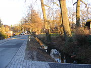
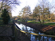
_-_2011.jpg) The Kleine Wümme in blockland |
||
| Data | ||
| Water code | DE : 49476 | |
| River system | Weser | |
| Drain over | Wümme → Lesum → Weser → North Sea | |
| Holter Fleet ( unclassified upper course) |
Alt-Osterholz , south-eastern outskirts 53 ° 3 ′ 13 ″ N , 8 ° 56 ′ 56 ″ E |
|
| Source height | 4 m above sea level NHN | |
| muzzle | at Dammsiel in the Wümme coordinates: 53 ° 9 '29 " N , 8 ° 46' 36" E 53 ° 9 '29 " N , 8 ° 46' 36" E |
|
| Mouth height | 2 m above sea level NHN | |
| Height difference | 2 m | |
| Bottom slope | 0.11 ‰ | |
| length | 16.6 km, with upper course 18.8 km (around 1800 as well as new course) | |
The Kleine Wümme is a left tributary of the Wümme in Bremen. The course of the river has been changed since the 12th century by the agricultural development of the Hollerland . With the residential development of the Vahr in the 20th century, parts of the course ended up in the sewer system. New canals were created in other places. The remaining part of the small Wümme between Horn-Lehe and the (large) Wümme would be a tidal body of water without the sluices in the Wümmedeich that go back to the 13th century . Today the Bremische Deichverband regulates water levels and currents on the right bank of the Weser .
River course

Historically two headwaters
One of the earliest depictions of the Kleine Wümme can be found on a map of the Lower Weser shortly before the middle of the 17th century, where it flows southwest past Osterholz , the Vahr and Horn . In the maps of the Bremen land surveys of the late 18th and early 19th centuries, there are two upper reaches. The source water of the southern one was today's Holter Fleet near the old town center of Osterholz. Down the river the course was straightened for about 5 km and part of the Landwehr around the Hollerland. The first section ran south next to Holter Strasse (today Sebaldsbrücker Heerstrasse ). After the Sebaldsbrücke, which connected Hastedt with Osterholz, the waters of the Vahrer Landwehr (today Vahrer Straße , In der Vahr and Bürgermeister-Spitta-Allee ) followed, where it is entered on the map of the village of Hastede from 1804 as Kleine Wümme . The next section has disappeared today under the villa development around the Alte Eichen street . The northern upper course originated in the north of today's Osterholz cemetery and flowed (around 1800) as a straightened canal along the Achterdiek and the Achterstrasse, which at that time also included today's Berckstrasse. Both united west of the Horner church.
Changes
With the construction of the so-called Blockland Autobahn between the junctions Bremen Ost (today Bremen-Sebaldsbrück) and Lesum from 1933 to 1937, the northern upper reaches of the Schorf (formerly the eastern part of Berckstrasse or Achterstrasse) were cut and the parallel canal on the Achterdiek at the Motorway exit Bremen-Mitte (today Bremen-Vahr ) created. As a replacement, a new fleet was laid west of the motorway route from Achterdiek above to Berckstraße below. At the beginning of the 1950s, the connection from the Holter Fleet to the junction of the Heufeldsfleet with the fleet on the Achterdiek was established. This created a new upper course of the Wümme from Alt-Osterholz to Berckstraße. After 1970 the western part of the upper reaches of the Berckstrasse was moved south to the border between the Botanical Garden and the Rhododendron Park.
Today's upper course
Nowadays the Holter Fleet has a pseudobifurcation , east of its apex near the street Ehlersdamm it flows towards Osterholzer Landwehr, and west to the southwest corner of Osterholzer Friedhof . After crossing under the Sebaldsbrücker- / Osterholzer Heerstraße it becomes the Kleine Wümme and flows north on the western edge of the cemetery. 200 years ago there was neither a cemetery nor a canal. The Vahrer Fleet is no longer part of the Kleine Wümme. It runs from Ludwig-Roselius-Allee to the Bremen-Vahr motorway junction next to the Achterdiek, where the fleet is old. The next stretch of water, west of the motorway, is no older than this. Then the Kleine Wümme flows in the form of a new, dead straight canal through the East-West direction through the Botanical Garden and Allmerspark. From the Ronzelenstraße school center to the Schwachhauser Heerstraße, it flows south of the Horner Church to the old union point. Recognizing the current course of the river in the official city map is made more difficult by the fact that some flow directions are incorrectly marked.
Middle course
The Kleine Wümme comes to light again at the Horner church . However, along Achterstraße and Wetterungsweg (still counted as Achterstraße around 1800), it is again heavily straightened. Shortly before crossing under Parkallee by the Munte, there are jetties and boathouses for several paddle and canoe clubs on the left bank. When the Wetterungsweg Small Wümme forms the border between the historical field of civil Pasture and the Wetterung said easternmost portion of the block land . In the Bremer Weidebrief a body of water called Coclake is defined as the rear boundary of the pasture. The name suggests a shallow lake, but should not be confused with Stadtwaldsee (Unisee), a sand pit that was created during the construction of the motorway in the 20th century.
_Gehrkenstau160626.JPG)
City forest and pasture dam area on the left bank of the river are former parts of the Bürgerweide.
At the waste-to-energy plant , the Kleine Wümme runs over the Gerkenstau. Originally it was downstream of the connection to the Neue Semkenfahrt . The new peat canal from the Wümme to the Findorffer Torfhafen was passable with sufficient water level. With the installation of the mixed water feeder at the thermal power station, however, the weir was placed upstream, near the university ring. In this way, water can flow unhindered from this feed line to the Wasserhorst pumping station. In the meantime, however, this feeder has only the function of an overflow for weather events with massive accumulation of surface water. In normal operation, the wastewater (unfortunately mixed water) from the Bremen districts to the right of the Weser except for Vegesack and Blumenthal is now pumped under the Weser to the Seehausen sewage treatment plant.
Lower course
Beyond the Autobahn 27 , the Kleine Wümme runs through the blockland and still shows much of its natural meandering. Nowadays, however, there is almost no current in this section. Blocklander Hemmstrasse has followed its turns on the right since the 12th century, and finally Waller Strasse on the left . Between these small streets and the river there are allotments and field trees. On the other side of the road there are several farms on Wurten, as well as one that is no longer inhabited.
Dammsiel

At the confluence of the Kleine Wümme in the Wümme , the Dammsiel prevents the tidal currents and other floods from penetrating the blockland. It was first mentioned in the year 1400. The passage secured by the gate was large enough for the barges with which most of the traffic in the Wümmen lowlands was handled at the time. The passage was only possible at low tide, as long as the gates were open. After it had happened several times that impatient boatmen broke open the gates at Wümmehochwasser, with corresponding damage to agriculture, a ship cover with winch and mud track was installed in 1808 . In 1835, the leaseholder of the cover was given permission to run a pub. When a fundamental renovation of the sewer became necessary in 1896, the opportunity was used to install a shaft lock. The lock received its current state in 1990/91. Since then it has had lift gates and therefore no longer a gate function. From a hydrological point of view, the mouth of the Kleine Wümme river system is now the Wasserhorst pumping station .
Inflows and outflows

One of the left tributaries was the Gete , to which the street name 'An der Gete' reminds us today. The canal along the Weidedamm and the Waller Fleet (GKZ 494762) have been preserved, which was expanded into a peat canal between 1824 and 1826. From the east a canal flowed along the 'Wasserstraße' (today Schorf, Berckstraße and the northern part of Riensberger Straße) as a union of several canals running from southeast to northwest, which are called Mittelkampsfleet, Achterkampsfleet and Rockwinkeler Achterkampsfleet, the area between Vahrer Fleth and Achterndiek, as well as one Part of the field mark between Achterdiek and 'Rockwinkler Straße' (today 'R. Heerstraße' and 'R. Landstraße') drained what is now the area of Nedderland, Achterdiekpark , Büropark, Achterdieksee .
The Kleine Wümme has been crossed by the Kuhgraben (1277 'Cograve') since the 13th century , which both shortened the inflow of Weser water from the Dobben and made it possible to drain into the Wümme through the Kuhsiel (GKZ 49472). Another link to the Wümme has been the (New) Semkenfahrt (GKZ 49474) since the 19th century .
Today's junction into the Maschinenfleet was only created when the Wasserhorst pumping station was built in 1862–1864 (GKZ = DE: 49492). Functionally, the Maschinenfleet is no longer a branch, but with 97.3% (average from 2002 to 2013) of the runoff, the actual underflow. The remaining 2.7% was pumped into the Wümme from the Kuhsiel pumping station.
photos
Holter Fleet on Osterholzer Dorfstrasse
Holter Fleet on the edge of Alt-Osterholz
Kleine Wümme at the Osterholz cemetery

Kleine Wümme in front of Ludwig-Roselius-Allee
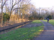
Kleine Wümme and Achterndiek on the A27
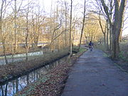
Kleine Wümme at the Botanical Garden

Kleine Wümme behind the Horner Church

Kleine Wümme on Achterstrasse

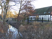
Boathouses and rollercoaster
road in Munte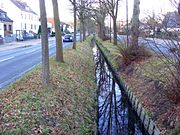
Median of Vahrer Strasse with Vahrer Fleet

Alte Kleine Wümme on the hawthorn path
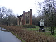
Old Wasserhorst pumping station (until 1987)


Basics
- Bremische Landesaufnahme 1794-1809 by CA Heineken, available in the Bremen State Archives as a reprint: Hans Dörries (ed.), Bremische Landesvermessung 1790–98 :
- Plate 14: Map of the Gohgrafschaft Hollerland, 1796
- Plate 11: Map of the village of Hastede, 1804
- Plate 15: Map of the village of Horn, 1806
- Plate 18: Map of the village of Rokwinkel, 1805
Individual evidence
- ↑ Hansewasser: sewage treatment plants
- ^ Dike association on the right of the Weser: Wasserhorst pumping station