Ludwig-Roselius-Allee
| Ludwig-Roselius-Allee | |
|---|---|
| Street in Bremen | |
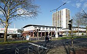
| Ludwig-Roselius-Allee at the Blockdiek EKZ | |
| Basic data | |
| city | Bremen |
| district | Hemelingen , Vahr , Osterholz |
| Cross streets | Vahrer Str., Unnamed streets, Georg-Gries -Str., Behind the Rennplatz, Im Holter Feld, Wiedensahlweg, Wilhelm-Busch -Weg, Bauer-Mecke-Weg, Hermann-Koenen -Str., Achterdiek, Bottroper Str., Gelderner Str., Max- Säum-Str., Düsseldorfer Str., Wuppertaler Str., Krefelder Str., Osterholzer Landstr. |
| use | |
| User groups | Cars, bikes and pedestrians |
| Road design | four lane road |
| Technical specifications | |
| Street length | 3350 meters |
The Ludwig-Roselius-Allee is a central access road in Bremen , districts Hemelingen , Vahr and Osterholz , districts Sebaldsbrück , Neue Vahr Südwest , Blockdiek and Ellener Feld . It mainly leads in a west-east direction from Vahrer Straße to Züricher Straße in Osterholz.
The cross streets and connecting streets were u. a. named after cities in North Rhine-Westphalia as well as Vahrer Strasse after the district, two unnamed streets (converging on the north and south sides), Georg-Gries- Strasse after the tobacco merchant and manager of Martinshof Bremen (1900–1977), two unnamed streets , Behind the racing course towards the Bremen racecourse , Im Holter Feld after the Vurholter Feldmark and Vorholt settlement (1181), or Vorholte (1313), which existed before the Dutch colonization, Wiedensahlweg after the birthplace of Busch, Wilhelm-Busch -Weg after the poet and writer, unnamed way, Bauer-Mecke-Weg after the figure in Max and Moritz von Busch, Hermann-Koenen -Straße after the politician ( SPD ) and member of the citizenship (1922–1978), Achterdiek = behind the dike , two unnamed lanes, Bottroper Strasse, unnamed lane, Max- Säum- Strasse (Blockdiek shopping center) after the architect (1901–1965), Gelderner Strasse, Düsseldorfer Strasse, Wuppertaler Strasse, Krefelder Strasse, unnamed lane , Osterholzer Landstrasse to the district and Züricher Strasse to the Swiss city; otherwise see the link to the streets.
Surname
The Ludwig-Roselius-Allee was named in 1962 after the coffee dealer, founder of the Bremen company Kaffee Hag and patron Ludwig Roselius (1874-1943).
As a patron he promoted artists like Paula Modersohn-Becker and Bernhard Hoetger and built the Böttcherstraße in Bremen as a work of art. The Ludwig Roselius Museum in Bremen bears his name.
history
Around 1798, on the site of today's road, there was the “Vahrer Feld”, which reached as far as the Achterdiek, behind which were the “Rockwinkeler Feldmark” and the “Ellener Feld”. By 1905 the situation was almost unchanged. The route of the later road was not yet available, probably there was one of the numerous parallel dirt roads in the area of the Vahrer Feld. The first development was the layout of the Bremen racecourse around 1907. Presumably in this context the street “Am Rennplatz” was created as a southern boundary. Later the Wilhelm-Busch-Siedlung was built to the east, the southern boundary of which was the “Zipperleinweg”. Both streets are on today's route.
The name was given in 1962, at that time only a middle section was planned, which was to be created by expanding the Wilhelm-Busch-Weg. For the time being, however, all the streets mentioned kept their names. Construction on Ludwig-Roselius-Allee began in the east, around 1966 it was built together with the new Blockdiek district . In this previously undeveloped area, a large curved curve was created to bypass the Ellener Hof.
The final route for the Wilhelm-Busch-Siedlung area was not decided until 1965. In 1968 the street in Blockdiek was finished and reached as far as Bählammweg, but could not be continued in the direction of Vahr as far as the street “Am Rennplatz” because a resident's claim for compensation had not yet been decided. By July 1970 at the latest, the road reached “Hinter dem Rennplatz”, and the local daily newspaper reported about an accident at this intersection. The extension past the racing course to Vahrer Straße took place in 1973, initially only with two lanes on what is now the southern lane, in 1977/1978 this section was also expanded to a four-lane road.
The street has been served by regular buses since 1981, initially only to the terminus Bottroper Straße and since 1990 through the entire street.
Just a few meters from the avenue, traces of pre-Christian settlement were found in 2018 and 2019 during development work for the foundation village of Ellener Hof. Finds and their origins were shown on a display board of the state archeology 2500 years of life on the Ellener Hof .
traffic
In local transport in Bremen, bus route 25 (Weidedamm-Süd ↔ Hauptbahnhof ↔ Osterholz) travels the entire length of the street, bus route 29 (Kattenturm-Mitte ↔ Neue Vahr-Nord) from Im Holter Feld to Hermann-Koenen-Straße and bus route 21 (Sebaldsbrück ↔ Universität-Nord) touches the street on Vahrer Straße.
Buildings and facilities
On the street there are first one- and two-story, then multi-story buildings.
Notable buildings and facilities
- No. 2: 30 hectare former racecourse Bremen from 1900: apartments are to be built here.
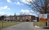
- 5-tier New building with Atlantic Hotel Galopprennbahn with restaurant
- Corner of Vahrer Straße: commercial buildings and shopping center
- To Hermann-Koenen-Strasse: 1- and 2-storey. Residential houses
- Between the racecourse to Achterdiek: Wilhelm-Busch-Viertel with 1-gesch. Houses from 1965 onwards; the streets are named after characters from the stories of Busch: Max and Moritz, Widow Bolte, Balduin Bählamm, Plisch and Plum, Uncle Fritz, Hans Huckebein, painter Klecksel, farmer Mecke
- No. 95: Evangelical Bethlehem Congregation, Bremen - Sebaldsbrück
- Between Hermann-Koenen-Straße and No. 181: 79.5 hectare Osterholz cemetery from 1910 onwards based on plans by garden architects Paul Freye and Franz Seeck with main chapel based on plans by Seeck, south chapel, honorary complex based on a design by Paul Halbhuber , sculpture Two mourners Gerhard Schreiter's wives ; Expansion of 30 hectares from 1948 according to plans by Horticultural Director Erich Ahlers
- Next to the Kleine Wümme from Achterdieck: allotment garden area
- From the allotment area to Bottroper Straße: 1- and 2-storey. Residential houses with flat roofs from 1970
- From no. 180: 4-tiered Residential houses
- No. 181: 4-sch. Foundation village Ellener Hof from 2015 on an area of 10 hectares
- No. 183: 3-sch. Forum Ellener Hof from 1996 as a day care center for the elderly and home for the elderly with 130 residential units and short-term care places
- Corner of Max-Säum-Straße 6 to 16: Blockdiek shopping center (EKZ Blockdiek) from 1966 with
- Kulturtreff , Postbank, café, restaurant, beverage market
- No. 210: 2-sch. Branch of the Sparkasse Bremen
- Gelderner Strasse 2: 18-storey. 49.5 m high residential high-rise from 1966
- Between Düsseldorfer Straße and Züricher Straße: 4 to 14-gesch. Residential houses
- No. 201 to 313: 2-cut. Terraced houses from around 1970
Art objects
- Wrought iron gate to the cemetery made of bronze from 1976 by Annette Diemer; Info: k: art in public space bremen
- Half-figure group death, solidarity with the mourners, overcoming mourning made of bronze from 1977 by Siegfried Neuenhausen in front of the Osterholz cemetery on Ludwig-Roselius-Allee; Info: k: art in public space bremen
See also
literature
- Herbert Black Forest : The Great Bremen Lexicon. 2nd, expanded and updated edition. In two volumes. Edition Temmen , Bremen 2003, ISBN 3-86108-693-X (first edition: 2002, supplementary volume A – Z). 2008, ISBN 978-3-86108-986-5 .
- Monika Porsch: Bremer Straßenlexikon , complete edition. Schünemann, Bremen 2003, ISBN 3-7961-1850-X .
Individual evidence
- ↑ Map of the area of the Reich and Hanseatic City of Bremen 1798
- ↑ 1905 city map
- ^ Gerhard Gimm (ed.): Bremer Heimatatlas . Published on behalf of the Senator for Education . 2nd Edition. Eilers & Schünemann, Bremen 1961.
- ↑ Wilhelm-Busch-Weg is renamed, Weser-Kurier dated December 6, 1962, p. 14, online only for subscribers
- ^ Blockdiek - young in every relationship, Weser-Kurier of October 26, 1966, p. 13, online only for subscribers
- ↑ Advisory board approved street plan - the draft for Ludwig-Roselius-Allee will not be changed, Weser-Kurier of October 23, 1965, p. 11, online only for subscribers
- ↑ Fierce dispute over rights of way prevents further construction of Ludwig-Roselius-Allee, Weser-Kurier of June 5, 1968, p. 13, online only for subscribers
- ↑ Advisory board approved street map - no green light for the Roselius-Allee, Weser-Kurier of June 21, 1968, p. 13, online only for subscribers
- ↑ Stadtumschau: Accident at the Ludwig-Roselius-Allee / Hinter dem Rennplatz intersection, Weser-Kurier of July 24, 1970, p. 10, online only for subscribers
- ^ Extension of Ludwig-Roselius-Allee past the Rennplatz to Vahrer Straße, Weser-Kurier of October 3, 1973, p. 11, online only for subscribers
- ↑ Restrictions when extending line 25, Weser-Kurier of October 16, 1981, p. 7, online only for subscribers
- ↑ Two bus routes finally extended, Weser-Kurier of March 30, 1990, p. 7, online only for subscribers
Coordinates: 53 ° 4 ′ 16.5 ″ N , 8 ° 54 ′ 35.3 ″ E


